A lack of sufficient rainfall has left 70 percent of Mexico suffering from drought conditions, with a third experiencing severe drought, the national water commission said, as Reuters reported.
“In the next 10 to 15 days, the country will experience the highest temperatures ever recorded,” National Autonomous University of Mexico (UNAM) researchers said in a statement, as reported by Reuters.
In the coming two weeks, temperatures in Mexico City could soar as high as 95 degrees Fahrenheit, said Jorge Zavala, UNAM’s director of the Institute of Atmospheric Sciences and Climate Change.
The capital city was one of several cities in the country that recorded its hottest day earlier this month, and most residents do not have air conditioning.
Since the beginning of the hot season on March 17, extreme temperatures have killed at least 48 people, with most dying from heat stroke and dehydration, Reuters said in another report.
Hundreds of others have suffered from sunburn and other heat-related conditions, according to health ministry data.
At this time during last year’s hot season in Mexico, three heat-related deaths had been reported.
According to meteorologists, a high-pressure heat dome over northern Central America and part of the Gulf of Mexico stopped the formation of clouds, leaving Mexico and parts of the Southern United States exposed to unrelenting sunshine and scorching temperatures, The Associated Press reported.
Warm, moist air was transported northward from the equator by tropical southerly winds, adding to the rare string of hot days.
The unusually high temperatures have killed people and animals, including threatened species like the endangered mantled howler monkey, who have been dying from what is believed to be dehydration in southern Mexico, reported Reuters.
Dr. Liliana Cortés Ortiz, a University of Michigan primatologist who is the vice chair of International Union for Conservation of Nature’s primate specialist group, said she was concerned about the plight of other species who are not as likely to be noticed, The New York Times reported.
Cortés Ortiz pointed out that, while species can adapt to changing conditions, things are happening “so fast, that it’s going to be very difficult for many species to adapt. There is not enough time,” as reported by The New York Times.
Scientists believe the increased temperatures — along with logging, deforestation and fires — may have combined to push the imperiled monkeys into smaller forested areas with lack of sufficient food, water and shade, The New York Times said.
“The animals are sending us a warning, because they are sentinels of the ecosystem. If they are unwell, it’s because something is happening,” said Gilberto Pozo, a biologist with nonprofit conservation group Cobius, as The New York Times reported.
The Norway chapter of World Wide Fund for Nature (WWF-Norway) is bringing a lawsuit against the Norwegian government for allowing mining of its seabed, claiming the country has not properly investigated the negative impacts.
WWF-Norway said the decision to proceed with deep-sea mining breaches Norwegian law and sets a “dangerous precedent,” a press release from WWF-Norway said.
“We hoped the notice of a lawsuit would prompt the government to reconsider and withdraw its controversial decision. Unfortunately, WWF-Norway sees no other options but to proceed with legal action,” said WWF-Norway CEO Karoline Andaur in the press release.
Last month, WWF-Norway announced that, if Norway did not change their decision to go ahead with deep-seabed mining — which the nonprofit said had no legal basis — it would take the country to court for its failure to comply with the minimum requirements of the Seabed Minerals Act’s impact assessment.
“WWF-Norway believes that the strategic impact assessment shows that the government does not have adequate knowledge about the marine environment in the deep sea to be able to assess the consequences of exploration and exploitation, either on the environment, other industries or the Norwegian economy. There are too many and too large knowledge gaps for the legal minimum standard of a strategic impact [assessment] to be met,” the press release said.
In January 2024, Norway approved commercial deep-sea mining following a study commissioned by the government concluding it would have minimal impact, reported Reuters.
“We believe that a thorough process has been carried out with broad involvement, and that the applicable requirements have been followed. I note that WWF wants to try the case in court, and they have the right to do so,” said Astrid Bergmål, secretary of state to the Ministry of Energy, as The Guardian reported.
Norway’s proposal would expose 108,108.6 square miles of sensitive Arctic waters to deep-sea excavation — an area larger than Britain — despite warnings of its “catastrophic” consequences for marine ecosystems, reported The Guardian.
Deep-sea mining involves extracting minerals and metals from the seabed for use in the transition away from fossil fuels.
A Norwegian study last year said a “substantial” amount of minerals and metals could be found on the country’s seabed.
The European parliament expressed concern in February about Norway’s decision to open up parts of the Arctic seabed to mining and called for support of a moratorium.
More than two dozen countries have joined in asking for a pause, ban or moratorium on deep-sea mining, including Germany, France, Spain, Mexico, Palau and Sweden.
It is expected that the International Seabed Authority will meet to ratify regulations on deep-sea mining in international waters later this year.
“We believe that the state is violating Norwegian law when they now open up for a new and potentially destructive industry without having sufficiently investigated the consequences,” Andaur said, as Reuters reported.
A lawyer for WWF said a court hearing could start in the next six months.
Xylem, a water technology company, has developed a Bavarian-style beer made in Germany. This isn’t an ordinary brew — this eco-friendly beer is brewed using wastewater.
The “Reuse Brew” is designed to showcase the latest in water recycling tech, according to the company, and is a collaboration among Xylem, the chair of Brewery and Beverage Technology at Technical University of Munich (TUM), the Chair of Urban Water Systems Engineering at TUM, and the city of Weissenburg in Bavaria.
The wastewater is first treated for solid waste, then filtered to remove trace substances that can come from pesticides, cosmetics and other products used by humans, Yahoo! News reported.
“The source of water should not determine its value, but rather its safety and quality,” Jörg E. Drewes, professor at TUM, said in a statement. “Our collaboration with Xylem on the Reuse Brew project underscores the practicality of converting wastewater into safe drinking water with existing technologies.”
In more complex terms, the water is treated using ozonation and oxidation via ultraviolet (UV) irradiation and hydrogen peroxide. For even better quality, the beer also goes through advanced filtration, including nanofiltration, and purification methods to remove any contaminants from the wastewater. As explained by Xylem, the oxidation processes and adsorption help remove contaminants such as chemicals and microbes, leaving behind clean water for beer production.
The company collaborated with Weissenburg to use its wastewater treatment plant to source treated wastewater for the Reuse Brew. The city’s wastewater plant uses ozonation technology from Xylem to remove micropollutants in sewer water.
“Reuse Brew is not merely an exceptional beer; it exemplifies the vast capabilities of water recycling in combating the pressing issue of water scarcity,” Roxana Marin-Simen de Redaelli, vice president of Central Europe and Nordics at Xylem, said in a statement. “This project is a beacon of modern, sustainable wastewater recycling technologies and underscores the importance of utilizing local resources to mitigate groundwater pressure and ensure supply security during periods of drought.”
According to Montana State University, which was not involved in the project, producing one gallon of beer at best requires two gallons of water, but many breweries may require four to eight gallons of water to produce one gallon of beer.
By using highly treated wastewater, brewers can reduce the amount of freshwater they need to draw to produce beer. While the Reuse Brew isn’t for sale, the public was invited to sample the beer last week and were pleased with the results.
“It should be said — it’s surprisingly good,” said attendee Sebastian Beck, as reported by Yahoo! News. “Because you’re doing something for the environment, we’re reusing water and I don’t notice any difference to a normal beer. It’s really good.”
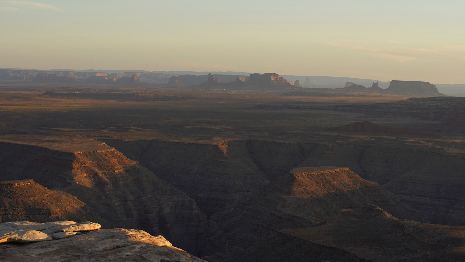
For a decade, wind farm companies had been eyeing Molok Luyuk — a mountain ridge of religious importance to tribes in northern California, whose people have worked for years to protect it. It’s also widely biodiverse with elk, mountain lions, and black bears, as well as 40 rare plants such as the pink adobe lily.
Mia Durham is the secretary for the Yocha Dehe Wintun Nation, a tribe that has been in a relationship with Molok Luyuk for thousands of years. In response to petitions filed by wind energy companies that wanted to develop the area, the tribe and its allies asked President Biden to protect it in 2019.
“That’s what heightened it for us and put us on track of moving forward as quickly as possible,” Durham said. “We wanted to protect sacred sites that are there. They were going to be severely impacted.”
One way to protect landscapes and waterways such as Molok Luyuk is to have them declared national monuments, a term used to designate that a section of land is federally protected from development and harm. While Congress designates national parks, only a president can designate a national monument.
That’s what happened earlier this month when the Biden administration expanded a national monument to include Molok Luyuk, joining the mountain ridge to the nearby Berryessa Snow Mountain National Monument, nearly 350,000 acres of coastal range in northern California. Tribes are now working on a co-stewardship agreement for the Molok Luyuk area, but not for the whole national monument.
But the tribes that have a relationship with Molok Luyuk aren’t done with their advocacy. They’ve protected the area from energy development, but they still have little say in how the land is managed. While the federal government has pushed co-stewardship agreements over the years, national monuments are still considered property of the federal government.
Now that Berryessa includes Molok Luyuk, the U.S. Forest Service and the Bureau of Land Management are in talks to enter into a co-stewardship agreement with the Yocha Dehe Wintun Nation, Kletsel DeHe Wintun Nation, and the Cachil DeHe Band of Wintun Indians of the Colusa Rancheria. The details are still being hashed out, but the Yocha Dehe Wintun Nation is excited to bring traditional knowledge to the management of Molok Luyuk.
Melissa Hovey is the manager at Berryessa Snow Mountain National Monument, and she said that co-management happens between the Bureau of Land Management and the U.S. Forest Service. These federal agencies can enter into co-stewardship agreements with tribes, but they can’t delegate management without congressional approval.
“Co-management means decision-making authority,” she said. “Co-stewardship means one entity still has the decision-making authority.”
You would think that “co-stewardship” and “co-management” would be simple terms to define, but there are numerous federal documents that have used the two terms interchangeably over the years. Co-stewardship is a broad term that describes agreements made between federal agencies and tribal nations to hash out shared interests in the management of federal lands. Co-management refers to a stronger tribal presence and decision-making power.
The Biden administration has been pushing co-stewardship as a model for how federal agencies can build relationships with Indigenous nations. Tribes were forcibly removed from much of their ancestral homeland in the U.S., and so many are dispossessed from medicines, food, and ceremonial places that are now under federal management.
In 2015, the Berryessa Snow Mountain National Monument was created under President Obama using the Antiquities Act — a 1906 law that allows the president to protect places of historic and scientific interest on federal land and make them national monuments. Berryessa was protected because of the area’s biodiversity: 80 different species of butterflies, black bears, California newts, and predatory birds. Molok Luyuk translates from Patwin to English as “Condor Ridge,” in reference to the endangered California condor that used to fly along the ridge.
Congressional action is not the only way to gain co-management powers. The Bears Ears Inter-Tribal Coalition in Utah has one of the most successful stories of tribes gaining co-management status — they were given “true co-management” by an Intergovernmental Cooperative Agreement. In 2022, the federal government agreed to co-manage Bears Ears National Monument with the Hopi Tribe, Navajo Nation, Ute Mountain Ute Tribe, Ute Indian Tribe of the Uintah and Ouray Reservation, and the Pueblo of Zuni. For the first time ever, tribal nations worked with federal agencies to draft a resource-management plan that would dictate how a national monument should be run.
Bears Ears National Monument in Utah is co-managed by the U.S. federal government and an intertribal coalition that includes six Indigenous nations. George Frey / Getty Images
Patrick Gonzales-Rogers is a professor at the Yale School of Environment where he specializes in tribal sovereignty and natural resources. He is also the former director of the Bears Ears Inter-Tribal Coalition.
Co-managment allows tribes to exercise sovereignty, according to Gonzales-Rogers. “It allows them to be more assertive,” he added. And when that happens, tribes can bring in religious and spiritual practices to utilize traditional knowledge, wisdom that had been minimized by federal agencies in the past.
Gonzales-Rogers is hopeful that, exponentially, these choices will compound, “and may even have a nexus to say something like landback” a reference to a movement that is not only rooted in a mass return of land to Indigenous nations and peoples, but also tribes having sovereignty to steward the land that was taken from them.
Gonzales-Rogers thinks the two terms have not been very well-defined over the years, but said co-stewardship agreements might be a good way to start building to co-management.
At the bottom of the Earth sits a massive bowl of ice you may know as the West Antarctic ice sheet. Each day, the ocean laps away at its base, slowly eroding the glaciers that line its rim. When they inevitably give in, the sea will begin to fill the basin, claiming the ice for its own and flooding coastlines around the world.
Thwaites Glacier is one of the bulwarks guarding against the collapse of this critical ice sheet, most of which rests below sea level and holds enough ice to raise the ocean by 60 meters, or about 195 feet. Unfortunately, this frosty Goliath, the size of Florida, is also one of the world’s most unstable and fastest-melting glaciers. While glaciologists knew its rate of ice loss was dire, they recently discovered that it’s exposed to far more warming water than previously believed. In a study published this week, scientists using satellite imagery and hydraulic modeling found that warming tidal currents are permeating the massive block of ice at depths as great as 3.7 miles, causing “vigorous melting.”
“We really, really need to understand how fast the ice is changing,” said Christine Dow, an associate professor of glaciology at the University of Waterloo and one of the study’s authors. “We were hoping it would take a hundred, 500 years to lose that ice.” Although the researchers do not know how much faster the ice is melting, they worry it could be gone within a few decades.
As climate change drives global temperatures ever higher, glaciers and ice sheets in polar and mountainous regions inevitably melt. The water and dislodged ice flows into the oceans, causing them to rise. Since 1880, global sea levels have climbed roughly 9 inches, and any sudden increase could be catastrophic for coastal cities like New York, Mumbai, and Shanghai. Low-lying countries like the Marshall Islands and Tuvalu could be submerged entirely.
Thwaites Glacier, often dubbed the “Doomsday Glacier,” already accounts for 4 percent of the planet’s sea level rise and loses 50 billion tons of ice annually. When it collapses, it could raise oceans worldwide by 65 centimeters, or just over 2 feet. “It doesn’t sound like a lot, but if you think of how much ocean water we have in the world, that’s a huge volume,” said Dow.
The study, published in Proceedings of the National Academy of Sciences, found that the pulsing of tides, which raise and lower the ice, allow water to creep further under its shelf and weaken its anchor to the seabed. While the same team observed this phenomenon at Petermann Glacier in Greenland, it had not been recorded in Antarctica. Thwaites has about eight times the amount of ice in contact with the ocean as Petermann.
Using high-resolution satellite images and hydrological data, the study identified high-pressure pockets where the glacier’s surface had been raised, which showed that warm water was flowing under the ice. Previous models had only used the part of the glacier that touches the ocean as the “grounding line” from which to start calculating the potential speed of ice loss from contact with warm, salty water. Now, according to the paper, researchers may have found the missing link in modeling how glaciers change.
“This boundary is a really crucial aspect in geology with respect to the glaciers’ response to a changing climate,” said Bernd Scheuchl, an Earth systems researcher at the University of California-Irvine and an author of the paper. He says a better understanding of the way ocean water can penetrate the base of a glacier can help scientists better predict ice loss across the West Antarctic ice sheet. “The entire region is the gateway to an area that’s well below sea level.”
Predicting the speed of ice loss and sea level rise is no easy task. Ever-shifting factors, like the amount of greenhouse gas emissions, could slow or accelerate global warming, and in turn, the rate that glaciers melt. And modeling glaciers, which are hydrologically dynamic, remote, and difficult to research, is a technological challenge that computers have only recently been able to handle, according to Dow.
Sharon Gray, a marine scientist at the nonprofit Rising Seas Institute, says research breakthroughs like this help the world prepare for and adapt to disappearing coastlines. “It’s never going to be perfect,” she said. “But obviously, the better we can get our models, the better we get our projections that help us plan.”
Given the complexity and uncertainty of modeling, Gray said it’s best to assume seas will rise to the highest predicted level and to prepare for worst-case scenarios. Some high-risk places, like Singapore and the Netherlands, are doing just that and have been investing in infrastructure to meet the challenge. “I think there’s hope and an opportunity in really thinking creatively and trying to wrap our heads around what’s coming and what we can do about it,” she said.
Researchers like Dow and Scheuchl say the best way to protect glaciers is to limit carbon emissions. Although the heat that humanity has already put into the atmosphere will linger for centuries and continue to melt glaciers, curbing the amount the planet warms could buy us time to prepare for, if not prevent, the most extreme outcomes.
“It’s never too late to make some change,” Scheuchl said. “Even if we aren’t able to stop these developments, we can slow things down and lessen their impacts.”
Eight young people from Alaska are suing their state government, claiming a major new North Slope natural gas project is in violation of their constitutional rights.
The plaintiffs — who range in age from 11 to 22 — allege that a law mandating development of the Alaska Liquified Natural Gas (LNG) Project infringes on the protection of their health and livelihood from the release of dangerous greenhouse gases, reported Reuters.
“Alaska’s youth are on the front lines of the climate crisis, and their futures depend on a swift transition away from fossil fuel,” said Andrew Welle, an attorney with Our Children’s Trust, a nonprofit law firm representing the plaintiffs, as Reuters reported.
Recently, two climate change lawsuits brought by youth in Alaska were dismissed. In the most recent — dismissed in 2022 — the state supreme court said courts were not able to order sweeping policy changes.
The current youth plaintiffs said their suit complies with earlier rulings of the court, however, since it focuses on an individual project, rather than challenging broad state fossil fuel policies.
The Alaska LNG Project would involve constructing a treatment plant for natural gas on Alaska’s North Slope, reported The Guardian. A liquefaction plant on the pristine Kenai Peninsula and an 800-mile pipeline stretching across the state would also be built.
The lawsuit said the $38.7 billion project, proposed by the Alaska Gasline Development Corporation, would triple greenhouse gas emissions for the state for decades to come.
“[Y]outh plaintiffs are uniquely vulnerable to and disproportionately injured by the climate harms that would result from the Alaska LNG Project,” the lawsuit said, as The Guardian reported.
The pipeline would bisect Alaska, carrying billions of cubic feet of gas daily from the North Slope through local communities, reported Reuters.
The youth plaintiffs said they are already experiencing breathing issues caused by smoke from climate change-fueled wildfires, as well as other harms such as a diminished ability to subsistence fish and hunt.
They argued that the Alaska LNG project would exacerbate climate change and asked the court to declare the state law mandating its development unconstitutional and stop it from proceeding.
The young Alaskans also requested a declaration that the state constitution include a right to a climate system that is life-sustaining. Alaska is the fastest-warming state in the country.
“[The Alaska LNG project] would drastically increase Alaska’s emissions at a time when climatologists are telling us that they need to be rapidly reduced in order to protect the health and safety of young people,” Welle said, as the Anchorage Daily News reported.
A 2022 report from the International Panel on Climate Change observed that more than 3.3 billion people around the world are “highly vulnerable to climate change.” And more than one billion people could be exposed to “coastal-specific climate hazards by 2050.”
Here in the U.S., the Census Bureau calculated that 3.2 million adults were displaced or evacuated due to natural disasters of all kinds in 2022. And while climate migration is not easily measurable, as there are multiple factors involved, it is no doubt happening.
Investigative reporter at Politico Abrahm Lustgarten delved into the topic of U.S. climate migration in his new book, On The Move: The Overheating Earth and the Uprooting of America. Seeking to understand what climate migration might look like over the next few decades, Lustgarten used data and reporting from places across the country such as New York City, California, Arizona, Chicago, Texas and the Gulf Coast, the Isle de Jean Charles in Louisiana, and from abroad in places like Guatemala and Africa.
Dense with facts and using modeling from Rhodium Group, a climate and economics research provider, to try and predict future migration patterns in the U.S., Lustgarten concludes that climate change migration depends on what happens next in the world of carbon reduction, politics and several other factors, resulting in a book analyzing “a portrait of American society transformed.”
Here are excerpts from a recent interview with Lustgarten.
Abrahm Lustagarten author photo by Seth Smoot
What are the most pressing short-term environmental threatsthat you write about?
Wildfires, coastal flooding, increasing heat, drought and water scarcity. I also collected some associated data on diminishing crop yields, change in wet bulb temperatures across the country and the economic implications of all of those things.
How was 2020 the tipping point, as you called it?
Instead of it being a sort of a scary far off in-the-distant-future idea, 2020 was a year where we were reading about smoke or hurricanes or flooding every day. Just a moment where the country seemed to grasp what we’re coping with.
What did your reporting tell you about who was going where?
The broad thesis of the book is that we will see a future projection of a movement of population from the South and the most extreme areas affected by both heat and sea level rise towards the North, which according to the specific risks that I mapped is the least affected part of the United States. We see current migration that’s sort of unmeasurable coming out of those high-risk areas already. People leaving Florida, people leaving the Gulf Coast, people leaving wildfires in California, anecdotally leaving heat in the Southwest, but it’s very difficult to measure.
Some of the things you write about are the economics of this migration. Tell me generally how disruptive it’ll be.
People move in response to the climate in slow steps and they go the shortest distance possible. It’s more likely that the rural places around them in those states kind of empty out over time because people will seek the support of those urban environments, that urban tax base, the facilities, the school systems, all of the services that are available. I could imagine an American Southwestern Texas that becomes islands of large, relatively wealthy cities, even in a sea of a much emptier rural expanse.
The second way to answer that question is, what’s the risk for places that are in decline? And this is a pessimistic scenario that universally all of the economists that I spoke with warn about, which is just what happens to a community that loses population for any reason. And it’s the same as what you see in the Rust Belt cities after the 1970s, what you see in post-boom coal towns and things like that. As some people leave, the businesses and the business community shrinks, storefronts might disappear, you have less revenue for the town, city, etc. That government can do less, which self-perpetuates this cycle, right? Your potholes don’t get repaved, and your schools don’t get fresh funding. More parents look at those schools and say, well, this sucks. And it is really hot here.
Do you think these kinds of economic impacts in certain areas might make people fully aware of the reality of climate breakdown?
I really think climate migration will happen in the United States, not because people say it’s too damn hot and I want to leave, or we think it’s going to flood and we’re going to move, but when it starts to affect people’s personal economic resilience. It ultimately will be economic-driven migration, which is catalyzed by climate change. It’s inevitable that when those kinds of things happen in culturally conservative parts of southern Louisiana or east Texas, that those people are not going to be hitting the streets complaining about climate change, but they’re going to be saying, “I can’t insure my home any longer. I can’t make a living any longer. Farming just doesn’t work anymore, and we’ve got to move someplace where we can take care of our families and make ends meet.” And a great example of that, of course, is the insurance blowback in Florida.
I wanted to ask you about wealthy people. Do wealthy people have a leg up in this whole situation? There’s been some land grabs up in Wyoming a little bit, and I think in Montana. Do you see that being magnified?
Wealthy people have an added layer of protection for all the obvious reasons. Interestingly, it’s actually kind of upper middle-class folks that are most likely to move, but wealthy people who might be the most protected because they have either the means to own properties in multiple places at once, or to move more spontaneously when they want to. There’s been a movement towards snatching up land in Wyoming or Montana, you know, or even in the Great Lakes — the data is very hard to pin with certainty to climate migration, but it appears to be part of the same kind of trend. Bill Gates is now the largest landholder in the United States, and he’s been buying up thousands of acres in northern Michigan, for example.
Might there be a new era of climate-migration boom towns, like the gold rush?
A lot of that upper Midwest and, you know, along the Canadian border, is rural and quite remote now. What if those cities grew dramatically and became the transportation corridor between the thriving metropolis Pacific Northwest and the Great Lakes region? That’s a far-fetched scenario, but one that’s possible. A place like Fargo — what the data says about Fargo is that its winters will be shorter and not as cold, and its summer seasons will be longer. And the data suggests that the crop yields in Fargo will likely increase while they decrease in other parts of the country. Fargo is the type of place that could see a relative improvement in its environment, a milder climate with probably increasing opportunity for agricultural activity. Which could lead to some kind of boom.
What might the abandoned places be like? Will any human ingenuity be able to make those places livable? Will it just be the very poor who will live there and can’t escape to go anywhere else?
It’s a dark question and a dark image, right? There’s a chapter in the book that looks as an example of this to a place called Ordway,Colorado. It’s a farming community that was very prosperous, but as a result of losing its water over the past 20 years or so has experienced a spiral decline. The people left and the schools shrunk in size. It’s an interesting sort of test case that shows us what the future might look like in other places that you’re asking about. There are people that love living there and will remain there and find their homes and their land beautiful. But, you know, as a community, it’s hard to say that it’s thriving. The people that I talked to there feel very sad about what they’ve lost and not particularly hopeful about the future of their community.
In places like Africa or Central America, in your reporting have you seen that a lot of people there are leaving because of climate migration?
My top line conclusion is I think we’re entering a new era of permanent, very high levels of global climate change migration all around the world. One very influential piece of research has looked at the human habitability niche around the world. And it models that about a third to one half of humanity will be displaced from this kind of ideal habitat in within the next 40 years. We’re talking about two to three billion people on the planet as potential migrants.
I spoke with migrants in El Salvador who, you know, wanted to leave because they’re experiencing gang threats in the city of El Salvador, but wanted to go home to their hometown in the mountains, but couldn’t because climate change had wiped out the coffee crop there. Climate change was rarely the primary driver but was always a present factor in these people’s decisions.
Hurricane season in the Atlantic basin is from the beginning of June to the end of November.
NOAA is predicting an 85 percent chance the season will be above-normal, a 10 percent likelihood it will be “near-normal” and a five percent chance there will be fewer storms than usual.
“All the ingredients are in place for an active season,” said Ken Graham, director of the National Weather Service, as USA Today reported.
The higher than normal predicted activity is due to a combination of factors, including La Niña conditions developing in the Pacific, near-record Atlantic Ocean temperatures and reduced trade winds and lower wind shear in the Atlantic, NOAA said. Together, these conditions favor the formation of tropical storms.
Light trade winds mean there is no disruption from strong wind shear, which minimizes ocean cooling while allowing hurricanes to strengthen.
Oceans globally are warming due to human-caused climate change. Melting land ice leads to sea level rise, increasing storm surge risk and the potential damage from any given hurricane.
“With another active hurricane season approaching, NOAA’s commitment to keeping every American informed with life-saving information is unwavering,” Spinrad said in the press release. “AI-enabled language translations and a new depiction of inland wind threats in the forecast cone are just two examples of the proactive steps our agency is taking to meet our mission of saving lives and protecting property.”
NOAA scientists are forecasting a swift transition to the La Niña conditions that tend to be favorable for hurricane activity in the Atlantic after one of the most potent El Niños ever observed.
Erik A. Hooks, FEMA’s deputy administrator, warned those living in areas prone to hurricanes to take precautions ahead of time.
“Severe weather and emergencies can happen at any moment, which is why individuals and communities need to be prepared today,” Hooks said in the press release. “Already, we are seeing storms move across the country that can bring additional hazards like tornadoes, flooding and hail. Taking a proactive approach to our increasingly challenging climate landscape today can make a difference in how people can recover tomorrow.”
A new report from the International Union for Conservation of Nature (IUCN) has found that about half of all mangrove ecosystems in the world are at risk of collapsing, meaning they are considered vulnerable, endangered, or critically endangered by the organization’s Red List of Ecosystem standards.
Further, about 19.6% of mangroves, nearly one in five, are considered to be at severe risk of collapse, meaning they rank as endangered or critically endangered, the report found.
The IUCN Red List of Ecosystems measures the health and risks of specific ecosystems, but this is the first time the standards have been used to assess an ecosystem at a global scale.
“The first global assessment of mangrove ecosystems gives key guidance that highlights the urgent need for coordinated conservation of mangroves — crucial habitats for millions in vulnerable communities worldwide,” Grethel Aguilar, IUCN director general, said in a press release. “The assessment’s findings will help us work together to restore the mangrove forests that we have lost and protect the ones we still have.”
IUCN reported that mangrove ecosystems face an increasing number of threats, particularly from the effects of climate change. Frequent and severe weather events threaten the mangroves, but they are particularly vulnerable to sea level rise.
Mangrove ecosystems, which require tropical, humid environments, are expanding into temperate areas because of climate change. According to IUCN, agricultural use of freshwater has also limited the amount of freshwater that can reach coastal areas where mangroves typically thrive, limiting the mangroves’ ability to survive in their natural habitats.
But sea level rise remains the biggest threat to mangrove ecosystems, the report highlighted. In a business-as-usual scenario, about 25% of the global area covered by mangroves currently could be submerged over the next 50 years, and about 33% of global mangrove ecosystems will be severely impacted.
At the current rate, the predicted mangrove losses would lead to a loss of 1.8 billion metric tons of stored carbon emissions, equating to a cost to society of about $336 billion. Losing these mangrove ecosystems could also expose 2.1 million people to coastal flooding.
“Mangrove ecosystems are exceptional in their ability to provide essential services to people, including coastal disaster risk reduction, carbon storage and sequestration, and support for fisheries,” said Angela Andrade, chair of the IUCN Commission on Ecosystem Management. “Their loss stands to be disastrous for nature and people across the globe.”
The report, while grim, concluded with next steps to curb emissions and preserve these important ecosystems, which can store more carbon than tropical forests and protect over 15 million people from coastal flooding each year.
IUCN recommended efforts to preserve and restore mangrove forests as well as providing more inland space for the mangroves to naturally expand to adapt to sea level rise.
As NPR reported, humans will need to pursue ways to curb emissions and the effects of climate change to further protect these at-risk ecosystems, such as through a clean energy transition.
“The Red List of Ecosystems provides clear pathways on how we can reverse mangroves loss and protect these delicate ecosystems for the future, helping in turn to safeguard biodiversity, tackle the effects of climate change and support the realisation of the Global Biodiversity Framework,” Andrade said.