Category: Latest Eco-Friendly News

Category Added in a WPeMatico Campaign

How does climate change threaten where you live? A region-by-region guide.

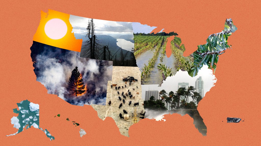
Every four years, the federal government is required to gather up the leading research on how climate change is affecting Americans, boil it all down, and then publish a National Climate Assessment. This report, a collaboration between more than a dozen federal agencies and a wide array of academic researchers, takes stock of just how severe global warming has become and meticulously breaks down its effects by geography — 10 distinct regions in total, encompassing all of the country’s states and territories.

The last report, which the Trump administration tried to bury when it came out in 2018, was the most dire since the first assessment was published in 2000. Until now.

The Fifth National Climate Assessment, released on Tuesday by the Biden administration, is unique for its focus on the present. Like previous versions, it looks at how rising temperatures will change the United States in decades to come, but it also makes clear that the rising seas, major hurricanes, and other disastrous consequences of climate change predicted in prior reports have begun to arrive. The effects are felt in every region. In the 1980s, the country saw a billion-dollar disaster every four months on average. Now, there’s one billion-dollar disaster every three weeks, according to the assessment. All of the many extreme weather events that hit the U.S., from the tiniest flood to the biggest hurricane, cost around $150 billion every year — and that’s likely a huge underestimate. 

“Climate change is here,” said Arati Prabhakar, director of the White House Office of Science and Technology Policy in the Biden administration during a briefing on the report. “Whether it’s wildfires or floods or drought, whether it’s extreme heat or storms, we know that climate change has made its way into our lives and it’s unfolding as predicted.”  

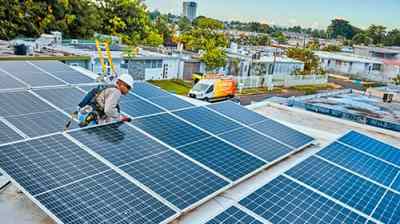
The report outlines steps every level of government can take to combat the climate crisis. And it takes stock of progress that has been made over the past four years. There’s good news on that front: President Joe Biden and Democrats in Congress have managed to pass historic climate measures that are expected to reduce the country’s carbon footprint between 32 and 51 percent by 2035, putting the U.S. closer to meeting its emissions targets under the global climate treaty known as the Paris Agreement. A number of cities and states have passed climate policies that can serve as a blueprint for what actions the rest of the country, and indeed the world at large, needs to take in the coming years. California’s clean car program and the Northeast’s regional carbon cap-and-trade program are two examples. 
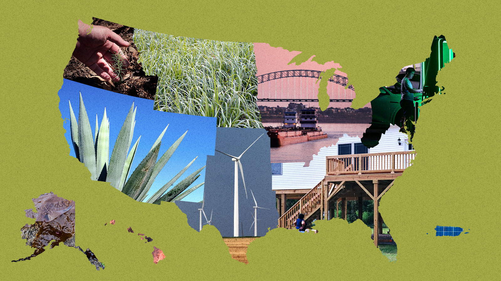
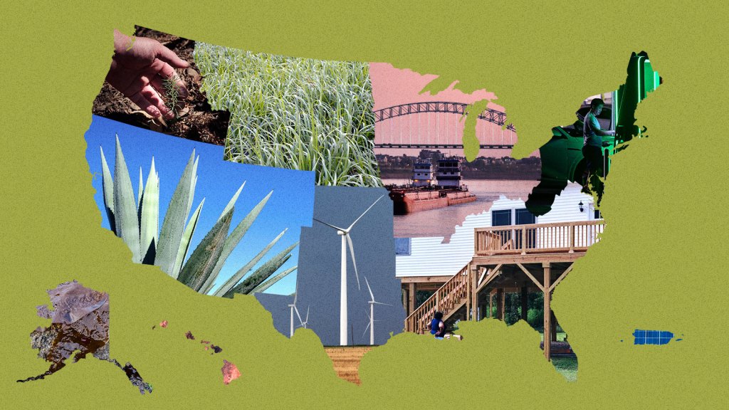
Despite this progress, climate impacts — oppressive heat domes in the Southeast that linger for weeks on end, record-breaking drought in the Southwest, bigger and more damaging hurricanes in the Atlantic basin, wildfires of unusual duration and intensity along the West Coast — are accelerating. That’s the nature of human-caused climate change: The consequences of a century and a half of burning fossil fuels are arriving now. Even if we stopped burning oil and gas tomorrow, some degree of planetary warming is baked in. 

This reality, the report says, leaves the country no choice but to adapt, and quickly. “We need to be moving much faster,” the Biden administration said. “We need more transformative adaptation actions to keep pace with climate change.” 

The Grist staff, located all over the country, reviewed the assessment to provide you with the most important takeaways for your region. Here they are. 

Shape of Alaska

Alaska

Salmon are vanishing from the Yukon River — and so is a way of life: As waters warm, Alaska Native families confront a world without the fish that fed them for generations.

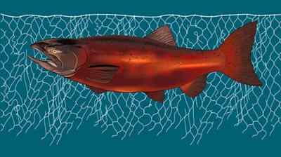
One of the joys of living in Alaska is being able to walk through thick brush without fearing that a tiny, eight-legged critter could latch onto you at any moment and give you a debilitating illness like Lyme disease (though, sure, grizzly bears are a worry). According to the assessment, that’s about to change: The western black-legged tick is creeping north, and it’s poised to establish a new home in the country’s largest state.

As Alaska warms two or three times faster than the rest of the world, it’s making life harder for many of the 730,000 people who live there, particularly Indigenous and rural residents who rely on hunting and fishing for food. Crabs are sweltering in the Bering Sea. Salmon are disappearing, leaving fish racks and freezers empty in Yup’ik and Athabascan villages along the Yukon River. Melting sea ice, extreme ocean warming, and toxic algae blooms are unraveling food webs, killing seabirds and marine mammals. It’s not pretty. 

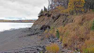
And it’s not all happening at sea. The ground beneath Alaskans’ feet is collapsing. Eighty percent of the state sits on permafrost, much of which is thawing. In Denali National Park, a melting underground glacier triggered a landslide in 2021 that forced the park’s main road to close for a few years. Add freak storms, flooding, and erosion to the mix, and Alaska Native communities face nearly $5 billion in infrastructure damage over the next 50 years, the report says.

There are a few bright spots. Higher elevations could see more snow, not less, and Alaska’s growing season is getting longer — a boon for a fledgling agricultural industry. Still, if you migrate north to start a farm, don’t think you’ll have found a refuge from wildfires, even in the Arctic. Just Google “zombie fires.”

Max Graham

Shape of Hawaii

Hawaiʻi and the Pacific Islands

Why Hawaiʻi’s seawalls are doing more harm than good: The military’s plan to build a seawall near Pearl Harbor might make the island’s sea rise problem worse.

Hawaiʻi, Guam, American Sāmoa, the Northern Mariana Islands, the Republic of Palau, the Federated States of Micronesia, the Republic of the Marshall Islands

Every month on the sixth day after a new moon, generations of Palauans have ventured out under the hot late-afternoon sun to toss their nets into seagrass meadows to capture rabbit fish. 

In 2021, the low tide didn’t come. Neither did the fish. The Indigenous fishers in Palau were left waiting, wondering if the higher tide would ever ebb.

It’s not yet clear whether climate change is to blame. But what is clear from the climate assessment is that rising sea levels, worsening storms, and other climate-related effects will transform the lives of nearly 1.9 million people who live in the states, nations, and territories that make up the U.S.-affiliated Pacific islands, many of them Indigenous peoples who have contributed little to climate change yet are bearing the worst of its impacts. 

Low-lying atolls in the Marshall Islands are already disappearing. The islands that remain risk losing their drinking water as saltwater intrudes on thin freshwater aquifers. In American Samoa, tuna canneries could see as much as a 40 percent drop in their catch by 2050 compared with the 2000s, according to the report, if carbon emissions don’t fall fast enough. 

In Hawaiʻi, a 3.2-foot rise in sea level could displace 20,000 people and cost $19 billion. That same scenario would affect 58 percent of the built environment on the island of Guam.

Maui residents still reeling from the horror of August’s wildfires can expect more drought on the leeward coast that could provide tinder for more flames. Already, fires burn a greater proportion of land area in U.S.-affiliated Pacific islands than on the continental U.S. 

Health care, already a longstanding challenge in the islands, is expected to get worse, as temperatures rise and mosquito-borne diseases like dengue and Zika proliferate. One study found 82 percent of heat deaths in Honolulu can already be attributed to climate change.

 — Anita Hofschneider

Shape of Midwest

Midwest

The Midwest defined itself by its winters. What happens when they disappear? For Midwesterners, climate change is playing havoc with traditions.

Illinois, Indiana, Iowa, Michigan, Minnesota, Missouri, Ohio, Wisconsin

If you’ve ever driven through Iowa, Illinois, or Indiana, you won’t be surprised to learn that the region produces almost a third of the world’s corn and soybeans. In fact, there are so many crops getting irrigated, water is evaporating off them and cooling summer days in parts of the Midwest, like central Wisconsin, countering some of the warming from climate change. But rapid swings between flooding and drought, along with the spread of corn earworms, Japanese beetles, and other pests, are hurting these staple crops and the farmers who grow them. Climate change, the report says, has also led to smaller harvests of wild rice, a staple that’s central to the identity of the Indigenous Anishinaabe. 

The region is getting more rain, and that’s promising for wheat production, but bad news for aging dams, roads, bridges, and wastewater facilities, which are already getting overwhelmed by water. The amount of precipitation during the 1 percent of rainiest days in the Midwest has increased by 45 percent since 1958, the report says.

The Great Lakes, the crown jewels of the Midwest, are among the fastest-warming lakes in the world, with climate change stressing out an ecosystem already plagued by toxic algae and invasive species and also reducing populations of walleye and trout. Warmer winters mean there’s less ice atop lakes and ponds, threatening traditions like ice fishing from Minnesota to Michigan.

Those less-harsh winters are also expanding the ranges of disease-carrying ticks and mosquitoes. Lyme disease has exploded in the Midwest to the point that it’s now endemic, and by 2050, the Ohio Valley may see more than 200 cases of West Nile virus every year. Another once-rare phenomenon that’ll become more common: wildfire smoke. Midwesterners got a preview this summer when smoke poured in from the fires in Canada, inundating Illinois, Michigan, and Ohio with “very unhealthy” air.

Kate Yoder

Shape of Northeast

Northeast

The Northeast’s hemlock trees face extinction. A tiny fly could save them.
The region can’t afford to lose these trees — or the carbon they store.

Connecticut, Delaware, Maine, Maryland, Massachusetts, New Hampshire, New Jersey, New York, Pennsylvania, Rhode Island, Vermont, Washington, D.C., West Virginia

When it comes to climate-fueled flooding, the 67 million residents of the U.S. Northeast are especially at risk, and the region’s aging stormwater and sewage infrastructure only makes matters worse. This summer, historic flooding in New York, Vermont, and Massachusetts killed multiple people and caused hundreds of millions of dollars in damage, a preview of flooding-related dangers to come. Extreme precipitation events have increased 60 percent across the entire region, which the report says could be due to a combination of more tropical storms and a warmer, wetter atmosphere. No other region in the U.S. has seen such a marked increase in rainfall. 

But climate impacts within the Northeast extend far beyond flooding. Days when real-feel temperatures are over 100 degrees Fahrenheit will triple by 2050 under an intermediate warming scenario, the report said, and communities that lack access to reliable and affordable air conditioning will see their health and general well-being decline as a result. 

The report also warns that states along the coast will have to confront the effects of warming water on marine species, fish stocks, and tourism — if they aren’t doing so already. In the Gulf of Maine, for example, lobster, oysters, and other shellfish are expected to decline. Animals that can migrate, such as right whales, will abandon the gulf for cooler waters north of the state. Sea bass, some types of squid, and other temperate marine species, on the other hand, will flourish. Warming winter nights are allowing damaging forest pests, such as the emerald ash borer and the woolly adelgid, to extend their ranges into colder latitudes and plague new ecosystems. 

Rising seas along the coastline will push homes and infrastructure inland, raising the controversial question of who gets to leave and who can stay. Already, home buyout programs and multibillion-dollar flood protection initiatives are underway in New Jersey and New York.

Zoya Teirstein

Shape of Northern Great Plains

Northern Great Plains

Reservation Dogs: Strange diseases are spreading in Blackfeet Country. Can canines track down the culprits?

Montana, Nebraska, North Dakota, South Dakota, Wyoming

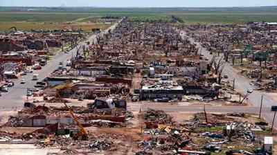
In parts of the country like southwestern Nebraska, it’s not uncommon for baseball-sized hail to fall from the sky during thunderstorms in the summer months. Unfortunately for people in the northern Great Plains, it’s likely to get worse: The region will experience the largest increase in hail risk, according to the report, along with more storms. By 2071, days with hail of two inches in diameter or more could increase threefold and cover almost nine times more ground. Hail that size can smash windows, dent cars, and cause severe injuries.

The report highlights a shift in the region’s water, so vital for the landlocked landscape spanning Montana, Wyoming, Nebraska, and the Dakotas. Decreasing snowpack could cut short winter tourism seasons and reduce available surface water, putting more stress on limited groundwater. At the same time, more flooding and extreme weather could hit communities with the fewest resources to respond. Two storms in 2018 destroyed nearly 600 homes on the Pine Ridge Indian Reservation, with half not repaired a year later.

Hotter temperatures have already limited harvests of traditional foods and medicine used by many indigenous nations. That includes wild turnips and chokecherries, culturally significant plants for the Lakota people. Rising temperatures have also dried the soil, raising wildfire risks. In the Great Plains grasslands, the number of wildfires has already more than doubled since 1985. Forest fires in Montana and Wyoming have shot up almost ninefold since the 1970s. All these trends are likely to get worse.

But these problems might not be enough to scare off newcomers trying to get away from droughts and wildfires elsewhere in the country. The report suggests that fewer cold snaps and a longer growing season in the Great Plains could lure people migrating from other regions in search of a new place to live.

Akielly Hu

Shape of Northwest

Northwest

In Portland, Oregon, extreme heat is making food trucks feel like ovens: “The sun is beating down on this metal box.”

Idaho, Oregon, Washington

Climate change might be putting an end to “Juneuary,” the term for the Northwest’s chilly early summers. Take the infamous “heat dome” that smothered Washington and Oregon in late June 2021. The searing heat melted electrical equipment in Portland, buckled roads outside Seattle, and led to nearly a thousand deaths in the two states (and British Columbia). Without climate change, a heat wave that intense would’ve been “virtually impossible,” according to one study cited. 

The report says the Northwest can expect hotter heat waves — and more deaths. Heat and wildfire smoke in the region have already led to thousands of deaths since 2018, when the last National Climate Assessment was published. Extreme heat is worse in formerly redlined neighborhoods like the Albina neighborhood in Portland, where temperatures can reach 13 degrees Fahrenheit hotter than the rest of the city. 

Most of the region’s drinking water has come from melting snow, stored in mountain ranges like the Cascades that run through Washington and Oregon, or the Sawtooth range in Idaho. But warmer winters are turning more snowstorms into rainstorms, leading to destructive floods in the winter and dry rivers in the summer. Glaciers are melting, even atop iconic Mount Rainier.

On the coast, rising waters pose problems. The town of Taholah on the Quinault Reservation along Washington’s northwest coast could see the ocean climb as much as 1.2 feet by 2050. The Quinault Indian Nation recently started to move many of its homes and government buildings farther inland. The report warns that the cost and complexity of managed retreat might make it difficult for other coastal communities.

Diminishing streams could be troublesome for numerous hydroelectric dams. Local and state governments might need to find new sources of energy to power the region’s electric cars and brand-new air conditioners — without relying on the fossil fuels that got us into this mess. 

Jesse Nichols

Shape of Southeast

Southeast

Why Florida’s home insurance crisis isn’t going away
Even if the market recovers from Hurricane Ian, climate change will likely keep prices high.

Alabama, Arkansas, Florida, Georgia, Kentucky, Louisiana, Mississippi, North Carolina, South Carolina, Tennessee, Virginia

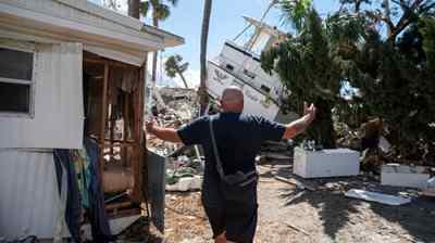
The sunny and fast-growing Southeast is on a collision course with climate change. Its cities have gobbled up more than 1.3 million acres of exceptionally biodiverse land since 1985, and more than a million people have moved to Florida alone since 2018. These newcomers are sitting ducks for worsening disasters, especially floods. The Southeast has seen almost two dozen hurricanes make landfall since 2018, and these monster storms are ballooning to full strength much faster as they cross a hotter Gulf of Mexico. The slow creep of sea-level rise has also led to more frequent tidal flooding in coastal cities like Miami. That’s bad news for the millions of people who have bought waterfront homes over the past few decades. 

To say the region is ill-prepared for this era of climate disaster would be an understatement. Many Southeastern cities are plagued with flimsy manufactured housing, antiquated drainage systems, and decades-old power grids. Heat stroke will become a bigger danger for outdoor workers, and more blackouts will knock out life-saving AC units in big cities. Louisiana saw more than 20 such events between 2011 and 2021. Warmer spring temperatures will also increase pollen counts in cities like Atlanta, worsening air quality. All these impacts will be more dangerous for the region’s Black residents, who live in hotter and more flood-prone places than their neighbors. 

The region’s declining rural areas also face existential threats, as industries find themselves unprepared for a warmer world. Farmers of cash crops such as citrus and soybeans, for instance, are fighting a four-front war against drought, flooding, heat, and wildfires, which all reduce annual yields. Extreme weather will continue sapping these moribund economies, leading to more out-migration and urban growth.

Jake Bittle

Shape of Southern Great Plains

Southern Great Plains

Abandoned in Osage
A century after the events of “Killers of the Flower Moon,” abandoned oil wells litter the Osage Nation.

Kansas, Oklahoma, Texas

The southern Great Plains encompasses a stunning variety of terrain, from the windy plains of Kansas to the swamps of East Texas. In some parts of the region, annual precipitation is as low as 10 inches, and in other parts it’s as high as 50 inches. Accordingly, the impact of climate change looks very different depending on where you are. In the high plains of Oklahoma, drought has drained rivers and aquifers for rural communities, but residents of large Texas cities like Houston and Dallas have to worry about floods overwhelming asphalt streets and clogged storm drains.

Kansas and Oklahoma don’t face the risk of the billion-dollar disasters that plague Texas, but the report finds that earlier springs in those two landlocked states have “reduced plant growth and diminished productivity” for all-important wheat and sorghum crops. Lyme disease-bearing ticks have started to appear even in the depths of winter, when they’re supposed to be hibernating.

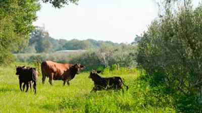
Energy is the backbone of the region’s economy, especially in Texas. This massive industry has helped accelerate climate change, and it’s also vulnerable to climate shifts: Hurricanes and increasingly large rain storms could knock out plants and refineries on the Gulf Coast. Agriculture and livestock, the other main industries, are also vulnerable to droughts: Dry spells in Kansas and Oklahoma have “increased labor demands for feeding, forcing producers to sell genetically valuable animals,” the report notes. These shifts could cost billions of dollars to the region’s economy.

The report also highlights threats to another mainstay of life in the South: football. Extreme heat and flooding could endanger athletes and force schools to postpone games. This already happened in 2021, when Hurricane Ida forced the Tulane University football team to play a game at the University of Oklahoma instead of at home in New Orleans.

Jake Bittle

Shape of Southwest

Southwest

The Water Brokers
A small Nevada company spent decades buying water. As the West dries up, it’s cashing out.

Arizona, California, Colorado, Nevada, New Mexico, Utah

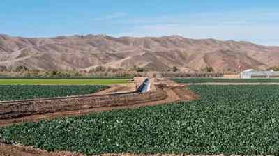
A succession of droughts, fires, and heat waves has thrown the Southwest’s economy into turmoil over the past decade, upending housing markets and stalwart industries like agriculture.

The most visible disaster in the region is wildfire. The already hot and dry Southwest is getting hotter and drier, which makes it easy for big fires to rage for weeks and even months, destroying thousands of homes. It also means that “fire season” now lasts roughly all year, as 2021’s Marshall Fire in Colorado demonstrated. The cost of putting out wildfires in California exceeded $2 billion that year, according to the report. As a result of all this damage, insurance costs are skyrocketing for everyone, even city dwellers who aren’t directly threatened by blazes.

On California’s coast, rising seas have eaten away at bluffs, causing stretches of road to collapse into the water. The authors of the report write that a rash of marine heat waves in the Pacific between 2013 and 2020 caused massive die-offs in the state’s salmon fishery and beached starving sea lions. Under the worst warming scenarios, the Pacific sardine fishery could migrate as much as 500 miles north.

In the desert, farms, ranches, and cities have drained reservoirs on big waterways like the Colorado River. Rural residents in California and Arizona are seeing their wells go dry during increasingly severe droughts, thanks in large part to thirsty nut and dairy farms that have sucked up groundwater. And drought has been even more challenging for the many Native American tribes. The Navajo Nation, for instance, lacks legal access to the Colorado River, so most residents haul their water by truck. Building new water infrastructure is more than 70 times as expensive on the reservation as it would be in the average U.S. town, according to the report

Jake Bittle

Shape of Puerto Rico

U.S. Caribbean

What could $1 billion do for Puerto Rico’s energy resilience? Residents have ideas. As the Department of Energy aims to boost energy reliability in Puerto Rico, local solutions are already doing just that.

Puerto Rico, U.S. Virgin Islands

The climate impacts facing Puerto Rico and the U.S. Virgin Islands don’t differ wildly from those of the continental states: Storms will strengthen, coastlines will shrink, temperatures will rise, and rainfall will diminish. 

What’s distinct about how the U.S. Caribbean territories will experience these hazards (apart from the islands’ location in a hurricane-prone ocean) are the economic and social conditions that have already made the region’s disasters more deadly — conditions that can be traced to the territories’ history as de facto U.S. colonies. More than 40 percent of Puerto Rico’s 3 million residents live below the poverty level, as do almost 20 percent of the 87,000 people living in the U.S. Virgin Islands.

After Hurricane Maria, which devastated Puerto Rico in 2017, mortality rates were higher for the elderly and those with the lowest household incomes. Studies found that nearly 3,000 excess deaths occurred after the storm because people lacked access to basic services.

That resource imbalance also shows itself in the dearth of necessary data available to assess current and future climate impacts in the region, especially in the U.S. Virgin Islands. The report is full of footnotes conceding that data was unavailable for the Caribbean territories.

Without improved social and economic resilience, U.S. Caribbean residents will continue to be uniquely vulnerable to storms, floods, and heat. 

“We may be facing more extreme hurricanes, but if we have the capacity, the quality of life, the social conditions to be prepared, it wouldn’t be that catastrophic,” said Pablo Méndez-Lázaro, lead chapter author and associate professor of environmental health at the University of Puerto Rico. “If we keep having a huge amount of people living under the poverty level, with preexisting conditions, exposed to flood areas, we will face another María.”

Gabriela Aoun Angueira

This story was originally published by Grist with the headline How does climate change threaten where you live? A region-by-region guide. on Nov 14, 2023.

Latest Eco-Friendly News

Every region of the country is taking climate action. Here’s how.

On Tuesday, the United States government published the Fifth National Climate Assessment — an exhaustive summary of the leading research on climate change and how it affects life in every part of the country. It may come as no surprise that its findings are dire. Impacts that we are already experiencing today, like the rate of temperature increase, frequent and extreme wildfires, and ongoing drought in the West, are “unprecedented for thousands of years.” These changes will only worsen for as long as society continues to burn fossil fuels, and for some time after. 

But the report also offers reason for hope. “The takeaway from this assessment, the takeaway from all of our collective work on climate, should not be doom and despair,” Ali Zaidi, the White House national climate adviser, said in a press call. Instead, he and others stressed, the message should be one of action and possibility. 

As the crisis has intensified, so have efforts to mitigate it. States, cities, businesses, and organizations across the country are taking increasingly large steps to reduce emissions — and those efforts are aided by the falling costs of renewable energy and other decarbonizing technologies. The report notes that the cost of solar energy has fallen 90 percent in the last decade, and the cost of wind power has dropped 70 percent. Between 2005 and 2019, greenhouse gas emissions in the U.S. decreased by 12 percent. Still, emissions must decrease far more rapidly than that by 2050 to keep us in line with international climate goals. 

In the meantime, communities across the country are taking the necessary steps to adapt to climate impacts, and in many cases, doing so in ways that address inequities.

Since the last National Climate Assessment in 2018, scientific advancements — increased confidence in the links between climate change and weather disasters, for example, and the connections between climate and environmental justice — have improved our understanding of the crisis and bolstered awareness. In the press call, Biden administration officials highlighted how the climate conversation has advanced in the last five years. That’s partly the result of more Americans feeling the effects of climate change in their daily lives. It’s no longer a question of whether the crisis is “real,” but rather what must be done to respond to it, and prevent as much harm as possible.

Grist writers from across the U.S. dove into the report to highlight some key solutions and adaptation strategies happening in each region. Here they are. 

Shape of Alaska

Alaska

How Alaska’s coastal communities are racing against erosion: “There’s a lot of history being washed away.”

Most Alaskans live near the ocean, and many depend on it for food and income. That’s one reason warming and acidifying seas pose so great a threat to their ways of life. Fewer salmon, cod, and shellfish means less food and fewer jobs. 

Fortunately, the ocean is also where many people are finding solutions. The Chugach Regional Resources Commission, an organization made up of seven Indigenous governments in south-central Alaska, is leading several projects aimed at helping coastal communities adapt to the changing ocean. 

One solution involves seeding beaches with clams — an important traditional food source for Native communities. Climate pressures like ocean acidification have made it harder for the mollusks to build and maintain shells. The Chugach commission raises clams, oysters, geoducks, cockles, and other coastal critters at the state’s only shellfish hatchery. It also oversees weekly testing for toxic algae blooms, which infect shellfish and have become a growing public health hazard fueled by marine heat waves. 

Alaska has also become a hub for kelp farming, which the report says can help suck up carbon, reduce acidification, and create jobs. One farm in the south-central region of the state grows oysters and mussels alongside kelp. Diversification, whether it’s on a single farm or across a local economy, can make towns more resilient, the report says.

That applies on land, too. Some communities have taken up agriculture to offset the loss of traditional food sources, like bird eggs that erosion has made harder to find. The warming climate may extend the growing season and open the door to cultivating new kinds of crops. In the Native Village of Port Heiden in southwest Alaska, residents started a farm to raise reindeer, poultry, and pigs, and the Knik Tribe in south-central Alaska is growing potatoes.

— Max Graham

Shape of Hawaii

Hawaiʻi and Pacific Islands

Water protectors in Hawaiʻi took on the US military and won. After 93,000 people were exposed to jet fuel-laced water, federal officials are finally cleaning up a leaking petroleum storage facility.

Hawaiʻi, Guam, American Sāmoa, the Northern Mariana Islands, the Republic of Palau, the Federated States of Micronesia, the Republic of the Marshall Islands

For hundreds of years in the Mariana Islands, Indigenous CHamoru people built homes on top of limestone pillars as high as 25 feet to protect against coastal inundation. This architectural feat, known as the latte stone, ended with Spanish colonization, but remains one of many examples of how Pacific peoples have innovated throughout history to adapt to their environments. 

The sea level was at least 3.3 feet higher between 2,000 and 4,000 years ago, when many of the first people crossed the Pacific to the Marianas and other archipelagos. With the ocean again rising, and intense storms, coastal erosion, and hotter days growing more problematic, the report highlights how Indigenous communities in the Pacific are drawing on their knowledge to address the pressures of climate change. 

One example is the revitalization of traditional food production. Renewed interest in cultivating native crops like taro helps restore local ecosystems and strengthen their resilience to threats like wildfires that feast on dry invasive grasses. Reviving Native farming systems can also help reduce the islands’ dependance on imported foods.

In Hawaiʻi, some advocates are exploring the possibility of a zoning category for “traditional lands” that would support sustainable housing communities along with culturally rooted farming and fishing. University of Hawaiʻi scholars have analyzed how traditional crops like breadfruit might fare in a hotter climate, and found the staple crop may remain resilient

In addition to embracing traditional knowledge, Pacific communities are emerging as leaders in the energy transition. Both Hawaiʻi and Guam have committed to using 100 percent renewable energy by 2045. The Hawaiian island of Kauaʻi is occasionally powered only by clean energy during the day, and in 2021 nearly 70 percent of the island was powered by renewable energy.

— Anita Hofschneider

Shape of Midwest

Midwest

Livestock are dying in the heat. This little-known farming method offers a solution. Silvopasture could make for healthier soil — and keep cattle alive during sweltering summers.

Illinois, Indiana, Iowa, Michigan, Minnesota, Missouri, Ohio, Wisconsin

Home to the Great Lakes and 500,000 miles of rivers and streams, the Midwest is blessed with water. But it’s possible to have too much of a good thing, as shown by the heavy rains brought by climate change. Flooding has caused up to $109 billion in damage to the region since the 1980s, with worse to come.

Remedies are at hand, according to the report, from repairing old dams to restoring natural floodplains. Wetlands, for example, are a cost-effective way to reduce flooding. The sponge-like ecosystems that once protected much of the Midwest were drained for development — Illinois and Ohio, for instance, have lost more than 90 percent of their wetlands in the past two centuries. Efforts to restore them are underway in both states.

The Mississippi, Missouri, and Ohio rivers are “critical lifelines” (and a low-carbon option) for transporting goods across the country, the report says. But swings in precipitation are jeopardizing locks and dams and leading to costly shipping delays of food and fertilizer. For the Ohio River, which carries 35 percent of the country’s water-based transport, the U.S. Army Corps of Engineers has devised a comprehensive plan to update aging infrastructure.

With dam failures and overflows from combined sewer and stormwater systems common, there’s more work to do. Many Midwest cities collect stormwater and sewage in pipes that can’t handle the volume of rain coursing through. The Milwaukee Metropolitan Sewerage District has spent $4 billion to fix this with a system of deep tunnels, stopping more than 145 billion gallons of pollution from spilling into Lake Michigan since the early 1990s.

The report suggests that retreating from repeatedly flooded areas — a strategy normally reserved for coastal towns — has already proven useful in the middle of the country. The town of Valmeyer, Illinois, moved uphill after a devastating flood along the Mississippi in 1993. It’s been called an early model of climate resilience.

Kate Yoder

Shape of Northeast

Northeast

The Northeast is poised to become a ‘hydrogen hub’: But nobody knows quite what that means yet.

Connecticut, Delaware, Maine, Maryland, Massachusetts, New Hampshire, New Jersey, New York, Pennsylvania, Rhode Island, Vermont, Washington, D.C., West Virginia

Large and deadly storms, like Superstorm Sandy in 2012, have hastened efforts to bolster infrastructure in the Northeast in preparation for the more severe impacts of climate change. The region is also home to a cadre of progressive governors who have championed climate action.

“Eight states in the region (Maine, New Hampshire, Vermont, Massachusetts, Rhode Island, Connecticut, New York, and New Jersey) have laws requiring emissions reductions of at least 80 percent by 2050,” the report says, a goal these states aim to achieve by restricting the use of fossil fuels and encouraging the growth of green technologies. Some go even further. Massachusetts, for example, will ban the sale of new internal combustion cars after 2035. A Connecticut law empowers cities to create their own stormwater management plans. Maine encourages climate education in public schools. 

Some of the most aggressive efforts to adapt to climate change are being led by the region’s federally recognized tribes. Last year, the Mi’kmaq Nation in northern Maine approved the Thirteen Moons Climate Adaptation Plan, which highlights the dangers warming poses to the traditional Mi’kmaq way of life. Maine’s winters have grown two weeks shorter as the state’s average temperature has increased roughly 3 degrees Fahrenheit since the 1800s. “Plants and animals are ‘behaving wrongly,’ that plan says, citing species like balsam fir trees and green crabs moving north to cooler climes. 

While most non-Indigenous populations across the U.S. have been slow to acknowledge the threats a changing climate poses to daily life, the Mi’kmaq Nation is clear-eyed about which traditions can be preserved and which must be adapted. Its plan recommends consuming more invasive plants, making warming and cooling centers accessible during extreme weather events, and determining whether to preserve “at all costs” the black ash trees that are used for basket-making — or pivot to alternatives.

Zoya Teirstein

Shape of Northern Great Plains

Northern Great Plains

The return of the American bison is an environmental boon — and a logistical mess. American bison are on the rise. The problem is, they don’t respect fences.

Montana, Nebraska, North Dakota, South Dakota, Wyoming

The northern Great Plains contain huge swaths of grasslands, home to iconic — but threatened — species like American bison, greater sage grouse, and black-footed ferrets. Over centuries, millions of acres have been developed or converted to crops. Restoring prairies and the wildlife they support could be a key strategy to reverse some of the environmental and climate challenges associated with agriculture, while boosting the region’s economy, the report says. 

Drier soils and limited surface water caused by climate change make it ever-harder to sustain thirsty crops like wheat and alfalfa. According to the report, converting farms to grasslands could help reduce water use, sequester carbon, and slow erosion. The switch to prairie grasses could be an especially viable solution on farmland that has already become less productive.

The report highlights one farm near South Shore, South Dakota, that grew switchgrass — a drought-resistant, native perennial that requires little fertilizer — at a higher profit than corn. Switchgrass can be burned to generate electricity, or turned into products like ethanol fuel or biochar, a charcoal-like substance that can be used to improve soil. But upping biofuel production isn’t without its drawbacks; producing and burning ethanol is at least 24 percent more carbon-intensive than gasoline, according to one study. And the biochar industry still faces hurdles in scaling up production and demand. 

Groups are also working to bring back native wildlife, like buffalo, a keystone species deeply tied to the cultures of many tribal nations in the northern Great Plains. Efforts to return the majestic ruminants are being led by groups like the InterTribal Buffalo Council, which has helped reintroduce them on nearly 1 million acres of tribal land. 

— Akielly Hu

Shape of Northwest

Northwest

How one town put politics aside to save itself from fire
Timber Wars tore this town apart. Wildfire prevention brought it back together.

Idaho, Oregon, Washington

Washington, Oregon, and Idaho are famous for their towering evergreens, an appeal for hikers, loggers, and Twilight fans. But the region’s lush forests, among the most carbon-dense in the world, are increasingly going up in flames, endangering homes and choking communities with smoke. A couple of decades from now, the risk of wildfires burning more than 12,000 acres will increase more than fourfold for parts of the region.

It’s a little counterintuitive for environmentalists, but the report says that tree thinning and other methods of removing vegetation could lessen the risk of severe fires in drier areas. Forests could also benefit from reintroducing controlled burns and incorporating Indigenous knowledge into fire management. Combining time-tested strategies with new technology, the Confederated Tribes of the Colville Reservation are using drones to monitor their forests. In Ashland, Oregon, loggers and environmentalists put aside their differences to protect their town by clearing brush, felling trees, and instituting regular maintenance burns.

Forests with more diversity — with varied amounts of shade tolerance and bark thickness, and different sizes of seeds and leaves — can better survive the changing climate, according to the report. It also recommends that people can help forests through “assisted migration,” or relocating species from where they grow now to where they are more likely to thrive in the future. On their own, most plants can’t migrate fast enough to outrun the changing climate. 

With the Northwest facing record die-offs of its iconic evergreens (which some scientists dubbed “fir-mageddon”), there’s a need for trees that can face harsh conditions. The Forest Service is experimenting with planting Douglas fir seedlings from Oregon in the cooler air of Washington’s Gifford Pinchot National Forest, southwest of Mount Rainier. There’s also an organized effort in the Seattle area to plant coastal redwoods and giant sequoias — prized, drought-tolerant species from California that are in danger as their native environment warms.

— Kate Yoder

Shape of Southeast

Southeast

Higher Ground: America’s oldest Black town is trapped between rebuilding and retreating.

Alabama, Arkansas, Florida, Georgia, Kentucky, Louisiana, Mississippi, North Carolina, South Carolina, Tennessee, Virginia

In its chapter on the Southeast, the report zeroes in on the tremendous risks facing the region’s cities, which are in a state of “unconstrained exurban and suburban sprawl.” Hurricanes and more intense rainstorms will destroy billions of dollars of property in cities from Miami to Atlanta, and local governments will have to retrofit everything from power grids to water treatment plants to protect residents from the blackouts and disease outbreaks that can follow big storms.

The best way to eliminate this risk, though, is to unwind the decades of construction that created it. The federal government has already started doing this by paying local governments to buy out and relocate communities in flood-prone areas. Officials in states like North Carolina have purchased thousands of vulnerable homes and knocked them down, giving residents money to move to higher ground. This strategy, known as managed retreat, will likely expand — but must be paired with corresponding restrictions on development. According to one study, for every home North Carolina bought out between 1996 and 2017, 10 more homes were built in the floodplain. 

Furthermore, these programs have well-documented equity issues: The report cites the historic Black town of Princeville, North Carolina, as an example of a successful buyout program, but Grist has documented the townʻs long and complicated journey to recovery. Even so, most experts agree that buyouts are the cheapest and best way to reduce future flood damages and save lives. A better funded and more forward-looking program, like New Jersey’s Blue Acres initiative, would go a long way toward reversing the South’s long trend of unsustainable development. In that program, officials hold counseling sessions with potential participants, and provide money to help defray moving expenses.

— Jake Bittle

Shape of Southern Great Plains

Southern Great Plains

This town was almost blown off the map — now it’s back, and super green: When the town of Greensburg, Kan., was nearly wiped off the map by a giant tornado, local residents decided to rebuild a town that would endure.

Kansas, Oklahoma, Texas

Many cities in the southern Great Plains have confronted the challenge of rebuilding after tornadoes and floods — most notably Houston, which saw three “100-year” floods between 2015 and 2017. In most cases, however, local leaders have chosen to respond by rebuilding the status quo.

Greensburg, Kansas, chose a different path. The prairie town of 1,400 was struck by a powerful tornado in 2007, which killed 10 people and destroyed 95 percent of its buildings.

After a series of public hearings, the city council required that new public buildings be capable of withstanding tornado-force winds, and installed natural retention ponds to catch stormwater. It also mandated that all large buildings meet the highest energy efficiency standards of the Leadership in Energy and Environmental Design, or LEED, program. 

The rebuild was a climate mitigation effort as well as a climate adaptation effort. Before the tornado hit, coal made up almost two-thirds of Kansas’ power mix, but Greensburg used the disaster as an occasion to shift to renewables. In early 2010, the city opened a 10-turbine wind farm that produces enough power for around 4,000 homes. The town now runs almost entirely on renewable energy and sells excess power to nearby cities. This transformation to a “green Greensburg” has changed local attitudes about sustainability, creating support for clean energy even in precincts that Donald Trump carried by a landslide in 2020.

Greensburg’s revival is an example of how cities can respond to disasters by dropping old development patterns, and reduce emissions in the process. The report also highlights how farmers in two other Kansas counties, Sheridan and Thomas, came together to agree on strict water restrictions when aquifers ran low. The farmers met the caps just by switching to more efficient irrigation techniques. 

Jake Bittle

Shape of Southwest

Southwest

At last, states reach a Colorado River deal: Pay farmers not to farm The Biden administration has temporarily resolved a dire water crisis — with help from a wet winter.

Arizona, California, Colorado, Nevada, New Mexico, Utah

Droughts come and go, but the water shortage facing the Southwest is here to stay. There’s a fundamental imbalance between the region’s enormous demand and its variable supply, and climate change is making that imbalance worse by reducing snowpack. The only real solution is to reduce consumption — and cities across the region are finding ways to do just that. 

Controlling water usage has to start with agriculture, and while progress in the industry has been slow, some producers have dramatically changed the way they grow. Farmers in California’s Central Valley have invested in more efficient drip irrigation systems, or have created “aquifer recharge” projects to store excess water underground until it’s needed in dry years. Others have shifted their planting calendars, or experimented with less water-intensive crops such as agave, but thirsty cash crops like alfalfa are still far more lucrative for most growers.

Cities are moving even faster. Los Angeles and other municipalities are spending millions to develop desalination plants and wastewater recycling facilities, easing their reliance on variable sources like the Colorado River. Phasing out wasteful applications has also proven to be an effective tactic: Las Vegas has spent the past decade ripping up thousands of lawns and replacing them with artificial turf or rockscaped yards, and the city’s water usage has plateaued even as its population surges. The report notes that studies have found “widespread support for innovative water management strategies” in cities like Vegas, as well as Denver and Phoenix. Now it’s up to elected officials to pursue those strategies. 

— Jake Bittle

Shape of Puerto Rico

U.S. Caribbean

Energy Department backs solar loans for low-income Puerto Ricans: The Biden administration wants to expand access to solar financing, but some resilience advocates disagree with the approach.

Puerto Rico, U.S. Virgin Islands

As Puerto Rico and the U.S. Virgin Islands prepare for worsening storms, rising seas, and intensifying heat and drought, a unique challenge undermines their ability to respond. Centuries of living under colonialist structures contributes to poverty rates much higher than most of the states, and excludes the territories from voting representation in the federal government.

“We have vulnerabilities that are limiting our capacity to cope,” Pablo Méndez-Lázaro, lead chapter author and associate professor of environmental health at the University of Puerto Rico, told Grist. For instance, after Hurricane Maria, thousands died because of a lack of basic services and inadequate government response.

But systemic failures have also created openings for Puerto Rico and the Virgin Islands to develop one of their most powerful climate solutions: a network of grassroots organizations that are adept at caring for their communities. 

The report highlights groups like Vieques Love, which improves emergency response infrastructure for remote areas in Puerto Rico, and the Foundation for Development Planning, which provides technical guidance on sustainable development in the Virgin Islands.

The next step is to get those groups talking to one another, said Méndez-Lázaro. “We are similar territories, facing similar hazards, with a similar history of colonialism, but we don’t have strong enough links to work for climate adaptation as a region,” he said, adding that the National Oceanic and Atmospheric Administration is creating a Caribbean Climate Adaptation Network to build partnerships between the two archipelagoes. 

Just as the task of building resilience has been decentralized, so too must the islands’ energy and adaptation systems, says the report. That can mean increasing access to rooftop solar and battery storage or installing home rainwater capture to hedge against water interruptions. Solutions like these change not just where infrastructure is located, but who controls it, empowering the people most affected by climate change.

Gabriela Aoun Angueira

This story was originally published by Grist with the headline Every region of the country is taking climate action. Here’s how. on Nov 14, 2023.

Latest Eco-Friendly News

New US climate report says land theft and colonization amplify the climate crisis for Indigenous peoples

The Fifth National Climate Assessment, a collaboration between 13 federal agencies and an array of academic researchers, takes stock of just how severe global warming has become and breaks down its effects by geography. Read about how climate change will impact your region of the country, and explore potential solutions to the crisis.


For the last 20 years, Walter Ritte has been working to restore a massive, human-made lagoon along the south shore of the island of Molokai. Before Hawaiʻi become a state, before the United States overthrew the Hawaiian Kingdom, this 55-acre pond was a fish farm — one of an estimated 450 brackish, coastal coves that fed an estimated 1 million people. Ritte is among a group of Native Hawaiians who have been working to bring the Molokai fishpond back to life. 

“Our future is our history, and we’ve gone away from that,” he said. “If we’re not self-sufficient, we are gambling with our lives here.” 

Ritte has rebuilt broken undersea walls and gates, removed predatory fish and invasive plants from the lagoon, reintroduced species that once thrived in the area, and monitored water quality. The goal, says Ritte, is to revive Indigenous aquaculture and reverse Hawaiʻi’s dependence on imported food, which makes up nearly 85 percent of all food on the islands.

But worsening rainstorms have raised worries. When the rain comes, it barrels down, transforming red dirt into mud that slides down the hillside into the sea, suffocating reefs and filling the fishponds Ritte has been trying to revive with sludge. As the impacts of climate change intensify, Ritte knows the challenge to revive, and preserve, Hawaiʻi’s aquaculture traditions will get harder. 

“One of the big reasons why Molokai was known as ʻāina momona, which means the ‘fat land,’ is because we had so much protein coming off the reefs,” he said. “All of this is in jeopardy because of a hundred years of excess erosion.”

Indigenous peoples, like Ritte, bear both the weight of climate change’s impacts and carry knowledge that may help lessen its burden. That’s according to the latest National Climate Assessment published Tuesday, a federal, interagency report published by the U.S. Global Change Research Program every five years. The report’s authors emphasized that American land theft and colonization have made Indigenous peoples more vulnerable to climate change as shrinking coastlines and more frequent extreme weather events threaten historic sites, cultural practices, and food supplies. 

“Historical abuses of Indigenous rights have significant responsibility for the heightened severity of climate disruption,” the report concluded. 

The report cites a 2021 study that concluded that Indigenous peoples in the United States lost 99 percent of their territories through colonization, and that the lands that they were forced to move to face higher wildfire risk and worse drought than their traditional homelands. According to the authors, Indigenous peoples across the continental U.S. and its island holdings hail from more than 700 tribes and communities, and while each community has a different relationship with the federal government, all share similar experiences of colonization through stolen land, cultural assimilation, and persistent marginalization. 

For example, the study noted that, on average, relocated Indigenous people endure two extra days of extreme heat. Nearly half saw an increased wildfire risk. More than a third of tribes studied are experiencing more frequent drought than they would if they were still living in their historical homelands. 

More flooding is another challenge. According to the report, 70 out of 200 Alaska Native villages are at risk of “severe impacts” from flooding, erosion, and permafrost melt, according to one 2022 federal report. The problem prompted the Biden administration to launch a new federal program, last year, to pay tribes to move away from rivers and coastlines threatened by flooding and other climate change effects. 

The report also detailed problems with the National Flood Insurance Program, a federal insurance program managed by the Federal Emergency Management Agency that helps homeowners insure against the risk of flooding, something that many insurance companies won’t cover. The program is supposed to help communities mitigate flood risk, but the report found that its implementation in Native communities has been flawed and ineffective: The program is mandatory for homeowners who live in flood-risk areas — even if they are Indigenous people who were forcibly moved to a danger zone — and premiums are costly. Tribes end up spending lots of money on floodplain managers and must shoulder the cost of creating and enforcing floodplain management ordinances, the report said. 

“The [National Flood Insurance Program’s] inability to support a diversity of Indigenous jurisdictions and effectively communicate program information inhibits Indigenous peoples’ success as program operators and beneficiaries,” the authors concluded.

Many Indigenous communities also lack data on their flood risk, a problem that reflects broader climate-related data gaps for Native peoples that the report repeatedly noted. Despite the input of hundreds of expert collaborators, the report noted the absence of data on Indigenous peoples, including missing maps of historical ancestral homelands in American Samoa, missing data on wildfire risks to the U.S’s island territories, and a broad lack of environmental data from Indian Country. The absence of data, the authors noted, represents a major systemic obstacle that impedes policymaking. 

Similarly, the report found that local, state, and federal governments often don’t do enough to involve Indigenous peoples in climate change response planning. Native communities that pursue such planning themselves are often hampered by lack of funding and staffing. Even when money is available to fund Indigenous-led projects, the money streams may not actually be constructed in a way to be actually accessible. Renewable energy projects, such as  a wind farm pursued by the Rosebud Sioux Nation, for example, have faced many challenges, including inadequate funding, questions about ownership of infrastructure, and bureaucratic hoops. 

The report concludes that supporting Indigenous self-determination is necessary to ensure Native communities’ needs are met, but also found that those efforts are undermined by policies and institutions that uphold state, local, or federal policies or prioritize the needs of the private sector.

“The right to self-determination means Indigenous peoples should be in the position to make decisions about how to respond to climate change in ways that meet community-defined needs and aspirations,” the report says.

Nationally, Native people lead more than 1,000 efforts to address climate change, drawing up hundreds of climate change adaptation and mitigation plans. In Washington state, the Swinomish Indian Tribal Community cultivates clam gardens to fight ocean acidification; in California, the Karuk Tribe has fought for their right to conduct prescribed burns.

Walter Ritte says the hot, humid summers are lasting far longer than when the 78-year-old Native Hawaiian activist was a boy on Molokai, and the rainstorms are more erratic, and fierce. Still, he is confident that better land management practices can help restore the fishponds, supporting more nearshore fishing, despite the climate threat. 

“The water is getting warmer and killing the reef, but it’s also the erosion coming from the land, and that we have the ability to mitigate,” he said. “I don’t know how to mitigate the temperature of the ocean, but I know how to mitigate the land, because that’s where I’ve lived and our ancestors did it. So that’s what we hope we’re going to do, what we know we can handle.” 

This story was originally published by Grist with the headline New US climate report says land theft and colonization amplify the climate crisis for Indigenous peoples on Nov 14, 2023.

Latest Eco-Friendly News

Iceland Prepares for Possible Volcano Eruption as Thousands Evacuate

Residents of Iceland, known as the land of fire and ice, are under a “significant” threat of the eruption of Fagradalsfjall volcano on the Reykjanes Peninsula, according to the Icelandic Meteorological Office, reported Reuters.

In 2021, the volcano reawakened after 800 years, spewing lava and continuing with volcanic activity for six months. An eruption from a separate fissure of the volcano occurred in August of last year.

In recent weeks, thousands of tremors recorded in the area, along with evidence of magma spreading underground, have warned of another imminent eruption.

The hundreds of earthquakes that have been shaking the peninsula have gotten weaker in the past couple of days, though scientists still anticipate the volcano to blow, BBC News reported.

“We believe that this intrusion is literally hovering, sitting in equilibrium now just below the earth’s surface,” said Matthew James Roberts, the meteorological office’s managing director of the service and research division, as reported by Reuters. “We have this tremendous uncertainty now. Will there be an eruption and if so, what sort of damage will occur?”

Nearly 4,000 residents were evacuated this past weekend as the activity threatened the coastal town of Grindavík, located about 42 miles southwest of Reykjavik.

Bill McGuire, University College London professor emeritus of geophysical and climate hazards, said that there was not any reason to believe the eruption would be particularly large, CNN reported.

However, McGuire added that “it is notoriously hard to forecast how big an eruption will be. The evacuated town of Grindavík is very close to the position of the new fracture, and its survival is far from assured. Everything depends upon where magma eventually reaches the surface, but the situation doesn’t look good for the residents of the town.”

Iceland is located between two of the largest tectonic plates in the world, the North American and the Eurasian, making it a hotbed of volcanic and seismic activity, Reuters reported.

“At around four on Friday, [the earthquakes] just started being non-stop. Just constant big quakes for hours,” Gisli Gunnarsson, a 29-year-old music composer who was forced to evacuate his hometown of Grindavik, told PA Media, as reported by BBC News. “We all rushed out of [Grindavik] so quickly, in a matter of hours, so we didn’t really think at the time that might possibly be the last time we see our home, so that’s been difficult.”

Most of Grindavik’s 3,800 residents had found places to stay with friends or family, with fewer than 75 utilizing evacuation centers, according to one rescue official, Reuters reported.

“It’s not only the people in Grindavik who are shocked about this situation it’s the whole of Iceland,” said Belgian-born Hans Vera, who has been living in Iceland since 1999, as reported by Reuters.

The post Iceland Prepares for Possible Volcano Eruption as Thousands Evacuate appeared first on EcoWatch.

Latest Eco-Friendly News

Newly Launched Satellite Detects Emissions From Industrial Facilities

GHGSat, a global emissions-monitoring company based in Montreal, has launched a satellite that will detect emissions from industrial facilities. The satellite can capture the facilities, such as power plants, in high resolution to more accurately track and attribute emissions.

The satellite, known as GHGSat C10 or Vanguard, launched on Nov. 10 from the Vandenberg Space Force Base in California.

While satellites that track emissions already exist, none are focused on tracking emissions from facility to facility. With high-resolution technology, the Vanguard satellite is designed to better monitor facilities’ emissions and lead to improved reporting.

“With regulators, investors and the public increasingly holding companies to account, for both their direct and indirect emissions, there is little doubt that better CO2 data is needed,” said Stephane Germain, CEO of GHGSat. “Trusted, independent data will help incentivize industry to manage its emissions effectively. It will ensure that climate policies are well-founded. Above all, it will help all of us stay on track to achieve Net Zero by 2050.”

In the past, GHGSat has used a satellite called Claire to pinpoint the sources of carbon and methane emissions. In total, the company has nine satellites that track emissions on land and offshore, and GHGSat has partnered with NASA, European Space Agency and the United Nations to provide satellite data. The Claire satellite’s collected data ultimately helped reveal that methane emissions were higher than previously estimated, and the new Vanguard satellite could provide similar findings for carbon dioxide.

Earlier this year, other satellites captured major methane leaks from a fossil fuel field in western Turkmenistan as well as methane leaks around the Gulf of Mexico coming from unplugged, or abandoned, oil and gas wells. Another satellite found a large methane cloud over Wyoming in February 2023, and the leaked gas was larger than the plant responsible had reported.

Such emissions-tracking satellites, like Vanguard, may help improve monitoring and reporting, according to GHGSat.

“Often what we find is a mix of direct measurements and estimates — therefore having a direct measurement of the entire facility from a satellite will act as a validation,” Germain explained, as reported by Reuters.

Carbon dioxide and methane are the top two greenhouse gases at 76% and 16%, respectively, of global emissions, the Center for Climate and Energy Solutions reported. The biggest industry greenhouse gas emitters include the fossil fuel, agriculture, fashion, transportation and construction industries, Climate Trade reported.

The post Newly Launched Satellite Detects Emissions From Industrial Facilities appeared first on EcoWatch.

Latest Eco-Friendly News

EU Agrees to Restore 20% of Its Lands and Waters by 2030

The European Union (EU) has agreed on a provisional agreement for a Nature Restoration Law — first proposed by the European Commission in June of last year — that would require member states to introduce measures for the restoration of 20 percent of the bloc’s land and sea ecosystems by 2030.

More than 80 percent of habitats in Europe are in “poor shape,” according to a press release from the European Parliament. The restoration law was proposed with the purpose of helping to repair the damage to nature across the EU, as well as to meet biodiversity and climate goals and international commitments, especially the United Nations Kunming-Montreal Global Biodiversity Framework.

In addition to the target of restoring a minimum of 20 percent of land and sea areas by 2030, all ecosystems would need to be restored by 2050.

In order to meet these goals, member nations must restore a minimum of 30 percent of the types of habitat covered by the Nature Restoration Law that are in “poor condition” to a “good condition” by the end of the decade, with an increase to 60 percent by the end of the following decade and 90 percent by 2050, the press release said.

“Europe is engaging, committing, not only to preserve and protect, but also to restore nature,” said Teresa Ribera, Spain’s ecological transition minister, as Reuters reported.

EU member states will need to use a transparent and inclusive process of adopting national restoration plans setting out how they plan to meet the targets, including giving priority to sites that are part of the Natura 2000 network. Co-legislators of the Nature Restoration Law also came to the understanding that after an area has been restored to a good condition, countries will try to make sure it does not deteriorate significantly.

Another part of the new law has to do with peatlands, which are important carbon sinks. Restoring peatlands that have been drained is one of the best ways to reduce agricultural emissions while improving biodiversity.

The new law will require EU member countries to establish organic soil restoration measures in areas used for agriculture that constitute drained peatlands. They must restore a minimum of 30 percent of these areas by 2030 and rewet a quarter; restore 40 percent with a third rewetted by 2040; and restore 50 percent with a third rewetted by 2050. Rewetting will remain a voluntary process for private landowners and farmers.

EU nations will also be required to reverse pollinator decline by 2030 at the latest, with an increasing trend thereafter, measured a minimum of every six years.

EU countries must also put measures in place to achieve an upward trend in several forest ecosystems indicators. Three billion additional trees will need to be planted and more than 15,000 miles of rivers restored to free-flowing status.

Countries must guarantee that urban ecosystems experience no net loss of total urban green space or urban tree canopy cover by the end of the decade, as compared to 2021. This must be increased after 2030, and progress will be measured every six years.

An emergency brake provision was agreed upon so that agricultural ecosystems targets can be suspended in the event of exceptional circumstances related to land required for food production.

“The agreement reached today is a significant collective moment. 70 years after the European project began, a European law for nature restoration is needed to address biodiversity loss,” said César Luena, member of parliament with the Group of the Progressive Alliance of Socialists and Democrats, in the press release. “Today’s agreement was possible thanks to the initiative and commitment of the Commission, the negotiating role of the Spanish Presidency of the Council, which prioritised this issue, and the understanding attitude of the parliamentary groups, especially the progressive groups, who have been able to work together and compromise to ensure the existence of a nature restoration law. Furthermore, I want to highlight and express gratitude for the crucial role played by the group of the social democrats in these negotiations, as without the unity of the S&D Group in support of this law, we would not be celebrating the adoption of an agreement today.”

The agreement must still be adopted by the European Parliament and Council and will be put before EU member countries and the European Parliament for final approval.

The post EU Agrees to Restore 20% of Its Lands and Waters by 2030 appeared first on EcoWatch.

Latest Eco-Friendly News