Old nightmares and new dreams mark the year since Kentucky’s devastating flood

The dream that haunts Christine White is always the same, and though it comes less frequently, it isn’t any less terrifying. 

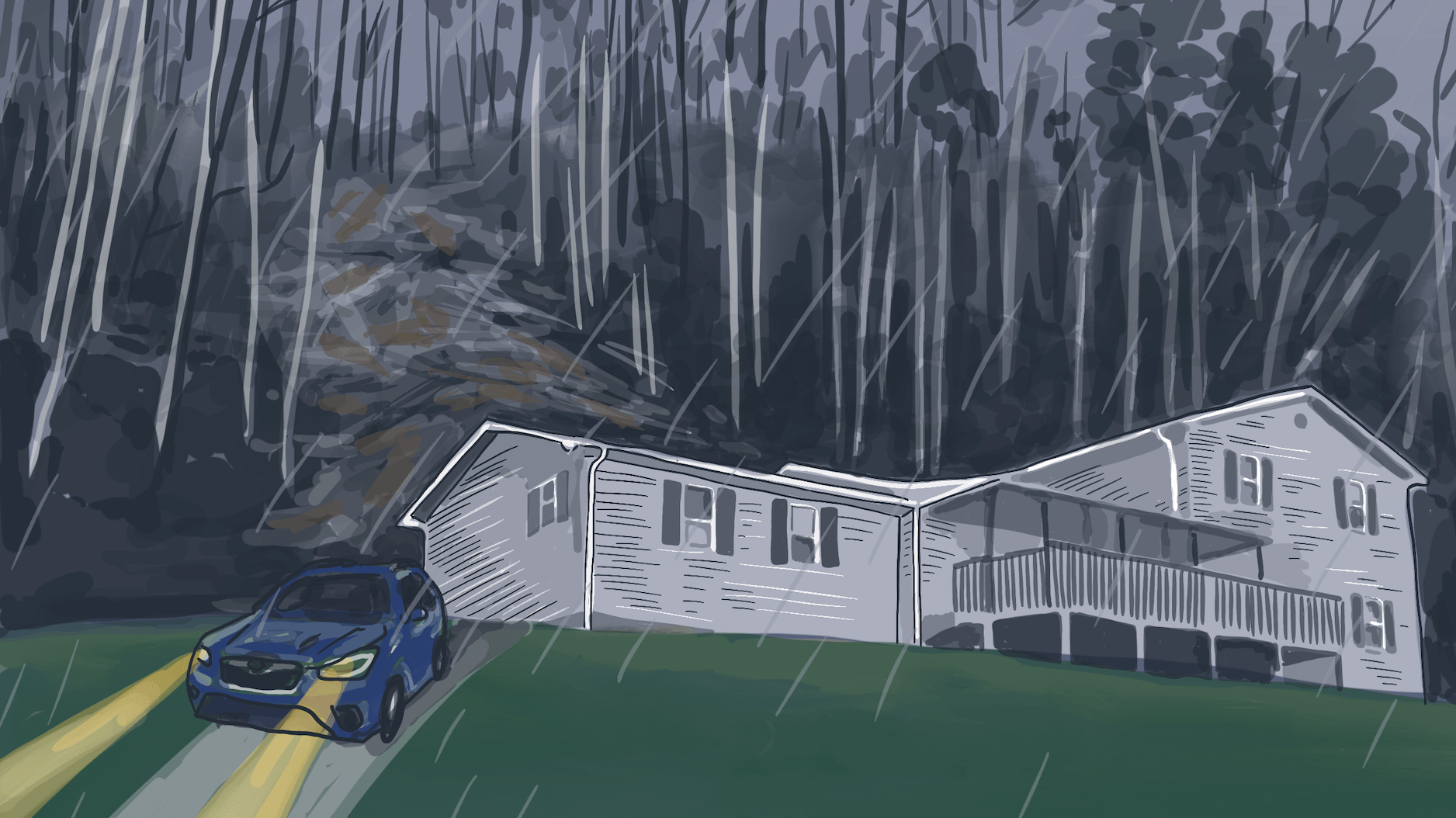
The black water comes rushing at the witching hour, barrelling toward her front door in Lost Creek, Kentucky. She’s outside, getting her grandson’s toys out of the yard. It hits her in the neck and knocks her off her feet before racing down a street that has become a vengeful river. She and her husband run to a hillside and scramble upward, grabbing hold of tree roots and branches. She finds her neighbors huddled at the top of the hill. As dawn comes, everything is unrecognizable, the land shifted, houses torn from foundations. They begin to walk through the trees, over the strip mine, out of the forest, in their pajamas and underwear with whatever they were able to carry when they fled. 

Then she wakes up.

That night used to replay every time White went to sleep. She started taking antidepressants six months ago, something she felt ashamed of at first but doesn’t anymore. They’ve helped a little, but the dream still haunts her, lightning-seared and vivid. 

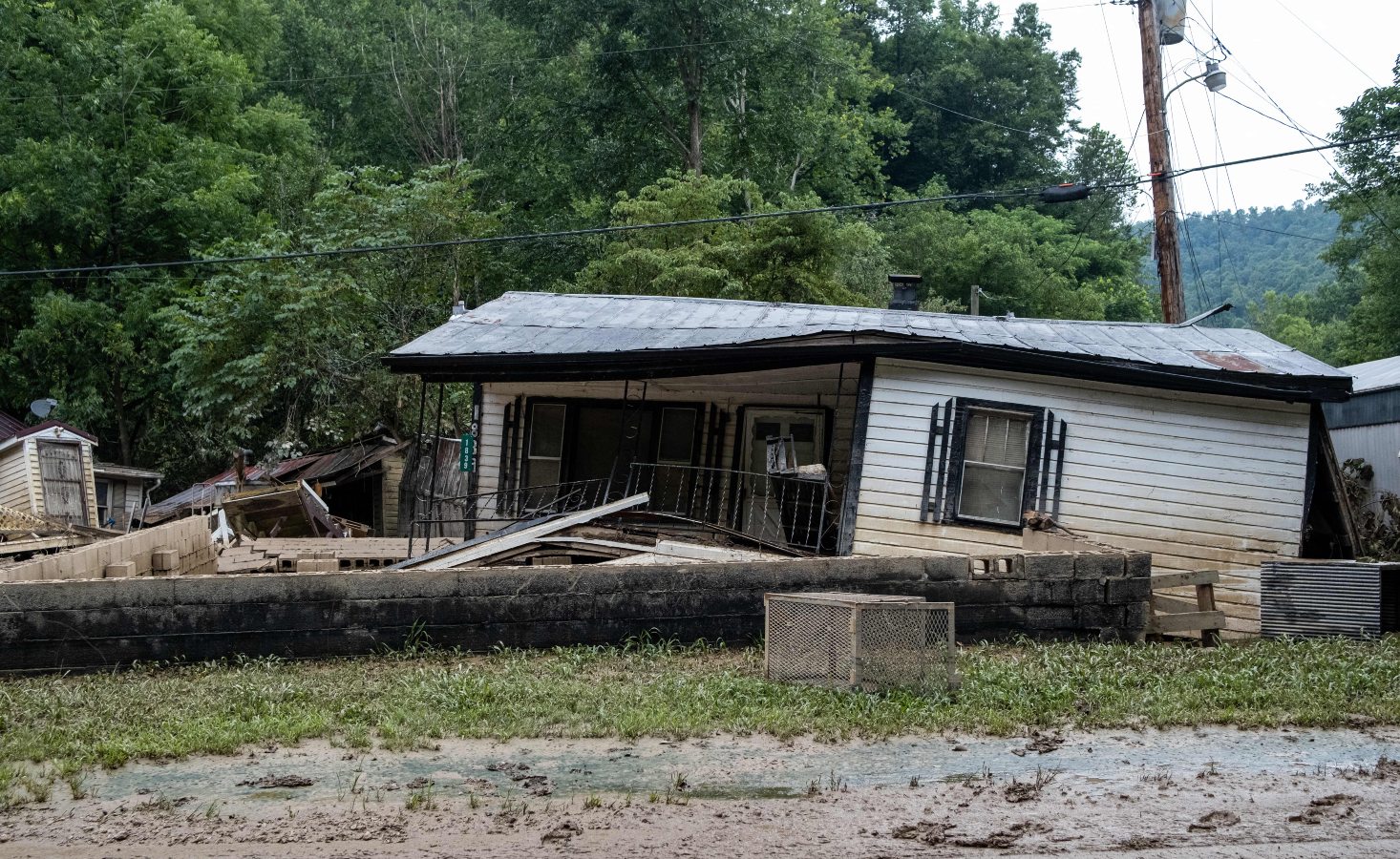
It’s been one year since catastrophic floods devastated eastern Kentucky, taking White’s home and 9,000 or so others with it. Her current abode — a camper on a cousin’s land — has become, if not home, no longer strange. But it’s the closest thing to home she’ll get till her new house, in another county, is finished. Lost Creek, though, is all but gone forever. What houses remain are empty husks. Some are nothing more than foundations overgrown with grass. 

White is never going back. “All the land is gone,” she said.
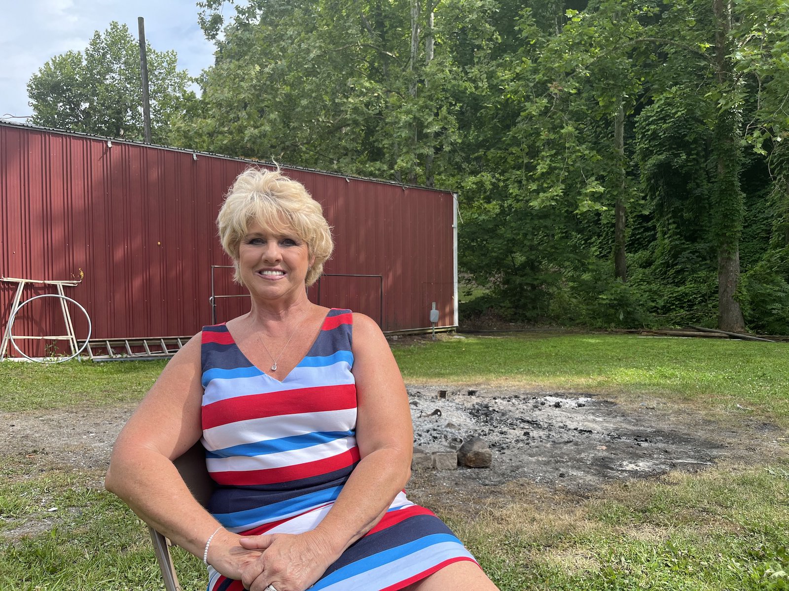
a woman in a colorful dress sits in front of a red structure
Christine White poses for a photo in Eastern Kentucky, one year after floods destroyed her home. Grist / Katie Myers

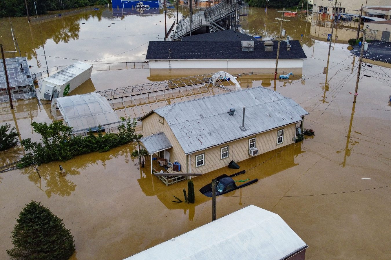
In the early hours of July 28, 2022, creeks and rivers across 13 counties in eastern Kentucky overran their banks, filled by a month’s worth of rain that fell in a matter of days The water crested 14 feet above flood stage in some places, shattering records. All told, 44 people died and some 22,000 people saw their homes damaged —staggering figures in a region where some counties have fewer than 20,000 residents. Officially, the inundation destroyed nearly 600 homes and severely damaged 6,000 more. A lot of folks say that tally is low, based on the number of residents who sought help from the Federal Emergency Management Agency. As of March about 8,000 applications for housing assistance had been approved. That’s half the number the agency received. 

The need for help, specifically housing assistance, was, and remains, acute. Most people here live on less than $30,000 a year, and at the time of the disaster, no more than 5 percent had flood insurance. Multitudes of nonprofits, church and community organizations, businesses, and government agencies have spent months pitching in as best they can. Yet there is a feeling among the survivors that no one’s at the rudder, and it’s everyone for themselves.

President Biden issued a federal disaster declaration the day after the flood, and his administration has disbursed nearly $300 million in aid so far. The state pitched in, too, housing 360 families in trailers parked alongside those from FEMA. Many of those have moved on to more permanent housing, but up to 1,800 are still awaiting a solution.

Some in the floodplains are taking buyouts — selling their homes to the federal government, which will essentially make the land a permanent greenspace. It’s a form of managed retreat, a ceding of the terrain to a changing climate. Some local officials openly worry that the approach doesn’t solve the biggest problem everyone faces: figuring out where on Earth people are going to live now. Eastern Kentucky was grappling with a critical shortage of housing even before the flood, and much of the land available for construction lies in flood-prone river bottoms. That has people looking toward the mountaintops leveled by strip mining.
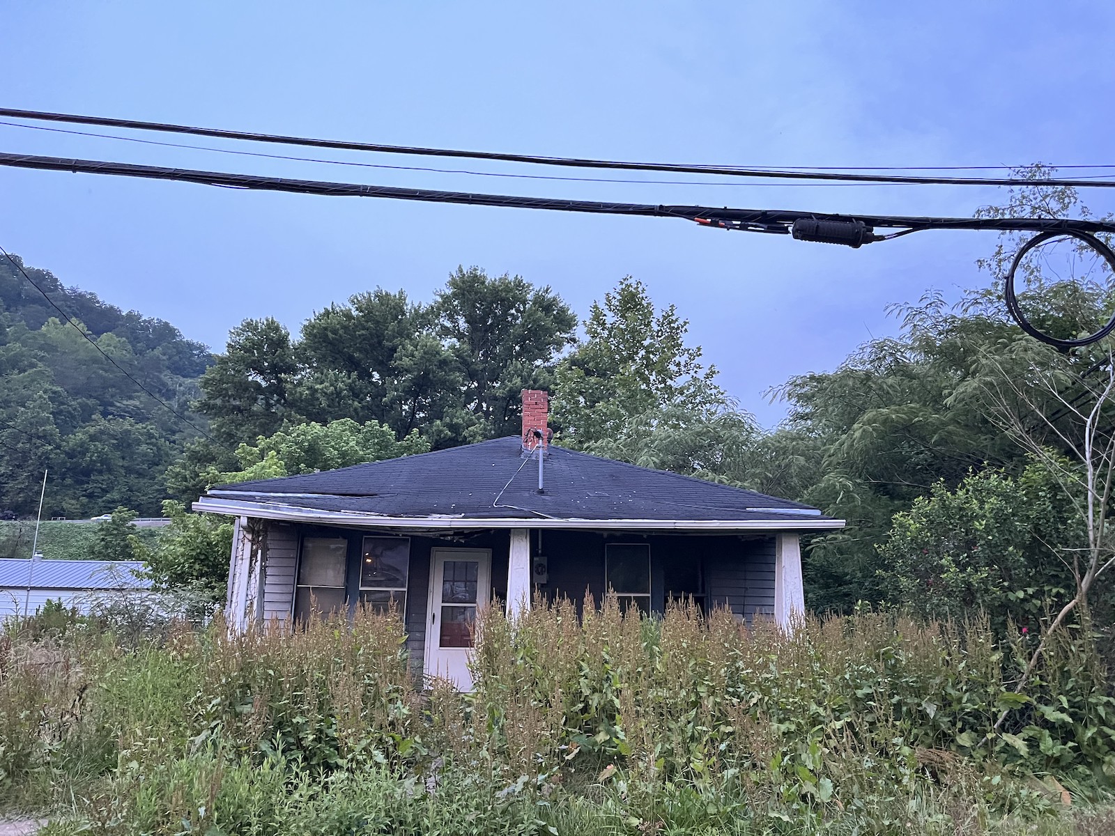
a house with weeds
A vacant building in Whitesbury, Kentucky, one year after floods devastated the Eastern part of the state.
Grist / Katie Myers

Kate Clemons, who runs a nonprofit meal service called Roscoe’s Daughter, sees this crisis every day. As the water receded, she started serving hot meals in the town of Hindman a few nights each week, on her own dime. She figured it would be a months’ work. She’s still feeding as many as 700 hungry people every week. Recently, an apartment building in Hazard burned down, displacing nearly 40 people. Some of them were flood survivors. They’ve joined the others she’s taken to helping find homes.

“There’s no housing available for them,” she said.


Clemons often brings food to Sasha Gibson, who after the flood moved with her boyfriend and nine children into two campers at Mine Made Adventure Park in Knott County. At first, she felt optimistic. “I was hoping that this would open up a new door to something better,” she said, after asking her children to go to the other trailer so she could sit for the interview in her cramped quarters. “Like this is supposed to be a new chapter in our lives.”

But the park, built on what was once a strip mine, became purgatory instead. 

Sasha Gibson, left, moved with her boyfriend and nine children into two campers at Mine Made Adventure Park in Knott County. Parker Hobson

Gibson, who lived on family land before the rains came, wants to leave. It’s just that the way out isn’t apparent yet. Many rentals won’t take so big a family. It doesn’t help that many of their identity documents were lost to the flood, making the search that much harder. She got some help from FEMA, but said the money went too quickly. 

A caseworker helps navigate a labyrinth of agencies designed to help Kentucky flood victims, and they’ve put in applications at a grab bag of charities building housing. One has told Gibson her case looks promising, but she’s still waiting to hear a final word. Other applications are so long and such a crapshoot — one ran 40 pages, for a loan she’d struggle to pay back — that she’s too tired to put them together.

“It’s a big what-if game,” she said. “They’re not reaching out to you. You’re expected to call them.”

Meanwhile, ATV riders sometimes ride through to the park, kicking up dust and leaving a mess in the restrooms. Gibson tries not to resent them. It’s not their fault she’s stuck.

“While it’s great and, like, they’re having a good time, it’s not a great time for us because we feel like we’re stuck here and we’re, like, an inconvenience and we’re in the way,” she said. “We don’t want to bother anybody.”

As extreme weather intensifies due to climate change, stories like Gibson’s will play out in more and more communities. Though eastern Kentucky hadn’t flooded like this since 1957, parts of the state could face 100-year floods every 25 years or so. About half of all homes in the region hit hardest by last year’s floods — Knott, Letcher, Perry, and Breathitt counties — are at risk for extreme flooding. 

Some residents worry that the legacies of surface mining – lost topsoil and tree cover, a ruined water table, and waste retention dams like the one that may have failed near Lost Creek, drowning it – will make communities more vulnerable to floods, compounding the effects of generational poverty and aging rural infrastructure. Housing needs to be built, and some say it needs to go up on the only high, flat land available — that is, the very same strip mines that contributed mightily to this whole problem in the first place.

High ground, especially former strip mines, in the region tends to be off limits. A study completed in the 1970s showed that most of what is available belongs to land companies, coal companies, and other private interests. About 1.5 million acres is believed to have been mined. Many of those sites are too remote to be of much use for housing, though, and those that are closer to town typically have seen commercial development. As the flood recovery has dragged on, though, some of these entities have decided to donate some of what they hold so that there might be more residential construction. Other parcels have been donated by landowning families with cozy relationships to the coal industry, though that hasn’t always gone smoothly.

Chris Doll is vice president of the Housing Development Alliance, a nonprofit dedicated to building single-family homes for low-income families. It was beating the drum of eastern Kentucky’s crisis long before the flood. The situation is even more dire now. Without an influx of new construction, he argues, the local economy will spiral even further.  

On an overcast and gentle day in June, Doll walked around a former strip mine turned planned development in Knott County called Chestnut Ridge. It sits near a four-lane highway and close to other communities, with ready access to water lines. The Alliance is working with other nonprofits to build around 50 houses here, along with, it hopes, 50 to 150 more on each of two similar sites in neighboring counties. A $13 million state flood relief fund has committed $1 million to the projects.  

a man in a t shirt and khakis in a field
Chris Doll stands in a field in Eastern Kentucky.
Grist / Katie Myers

The road leading to what could, in just a few years, be a bustling neighborhood opened up into a bafflingly flat landscape, almost like a wooded savanna. It was wide open to the sunshine, unlike the deep hollers and coves that characterize this part of eastern Kentucky. To an untrained eye, it appeared to be a healthy ecosystem. Look closer, though, and one sees the mix of vegetation coal companies use to restore the land: invasive autumn olive, scrubby pine trees, and tall grasses, planted mostly for erosion control.  

Still, it’s ideal land for housing, and most folks around here won’t mind the landscaping. Doll said the number of people who need help is overwhelming, and his team can’t help everybody. But they hope to build as many houses as they can.

“There are so many people that have so many needs that I am of the mindset that I will help the person in front of me,” Doll said. “And now we can turn them into homeowners. If that’s what they want.”

On a hillside overlooking another mine site, Doll and I walked up to the ridge to see if we could get a better view of the terrain. It is covered in a thicket of brush, too dense to see beyond. The path wound toward a small clearing, where worn headstones and stone angels sit undisturbed. Family cemeteries are protected from strip mining, and this one was clearly still cared for; the bouquets at the angels’ feet were fresh. The lifecycle of coal had come and made its mark and gone. 
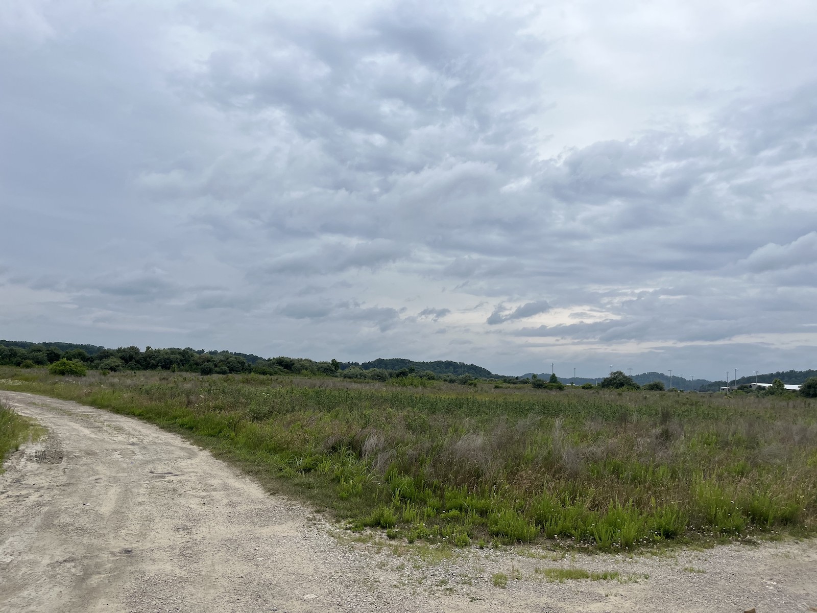
Chestnut ridge is a former strip mine turned planned development in Knott County, Kentucky. Grist / Katie Myers

“You can see where they cut out,” Doll said. “They just entirely destroyed that mountain. It’s such a wild thing to think that strip mine land is going to be part of the solution.” 

Doll thinks of it as a post-apocalyptic landscape, or maybe mid-apocalyptic, ripe for renewal, but still carrying the weight of its past. The land was gifted by people whose money was made from coal, after all.

“And, you know, it’s great that they’re giving land back,” he said. “I would prefer if it was still mountains, but if it was mountains, we couldn’t build houses on it. So yeah, it’s ridiculously complex.” He shrugged.  “Bigger heads than mine.”

He squelched across the mud and back to the car. In the summer heat, two turkeys retreated into the shade of a scrubby pine grove, their tracks etched in the mud alongside hoofprints, probably from deer and elk. The place was alive, if not exactly the way it was before.  


The former strip mine developments are financed in part by the Team Kentucky flood relief fund created by the governor’s office. Beyond the four projects already in motion, eastern Kentucky housing nonprofits like the Housing Development Alliance are working with landowners, local officials and the governor to secure more land in hopes of building hundreds more homes. 

“Working together – and living for one another – we’ve weathered this devastating storm,” Governor Andy Beshear said last week during a press conference outlining progress made since the flood. “Now, a year later, we see the promise of a brighter future, one with safer homes and communities as well as new investments and opportunities.”

That said, nothing is fully promised just yet, and the process could take years. The homes will be owner-occupied and residents will carry a mortgage, but housing advocates hope to lower as many barriers to ownership as possible and help families with grants and loans. Applications for the developments are expected to open within a couple of months. The plans, thus far, call for an “Appalachian look and feel” that combines an old-style coal camp town and a suburban subdivision to create single-family homes clustered in wooded hollers. Though some might argue that density should be the priority, local housing nonprofits want developments that feel like home to people used to having a bit of land for themselves. 

The Housing Development Alliance has built houses on mined land before, and some of them are among those given to 12 flood survivors thus far. Alongside other entities, it has also spent the year mucking, gutting, and repairing salvageable homes, often upgrading them with flood-safe building protocols.  Even that comparatively small number was made possible through support from a hodgepodge of local and regional nonprofits, and the labor of the Alliance’s carpenters has been supplanted with volunteer help. 

Though the Knott County Sportsplex, a recreation center built on the mineland next to Chestnut Ridge, appears to be sinking and cracking a bit, Doll said houses are too light to cause that kind of trouble.  Nonetheless, geotechnical engineers from the University of Kentucky, he said, are studying the land to make sure there won’t be any unpleasant surprises. The plan is for the neighborhoods to be mapped out onto the landscape with roads and sewer lines and streetlights, all of which require the involvement of myriad county departments and private companies; then the Alliance and its partners will come in and do what they do best, ideally as further disaster funding comes down the line. 

Still, all involved say that there’s no way they can build enough houses to fill the need.

A flood-damaged building sits vacant in Lost Creek, Kentucky
A flood-damaged building sits vacant in Lost Creek, Kentucky.
Grist / Katie Myers

More federal funding will arrive soon through the U.S. Housing and Urban Development disaster relief block grant program. It allocated $300 million to the region, and organizations like the Kentucky River Area Development District are gathering the information needed to prove to the feds the scale of the region’s need. Some housing advocates are critical of this process, though. 

Noah Patton, a senior policy analyst with the Low-Income Housing Coalition, said HUD grants are too unpredictable to forge long-term plans. “One reason it’s exceptionally complicated is because it is not permanently authorized,” he said. A president can declare a disaster and direct the agency to release funds, but Congress must approve the disbursement. Although it all went smoothly in Kentucky’s case, the unpredictability means there are no standing rules on how to allocate and spend funding.

“Oftentimes, you’re kind of starting from scratch every time there’s a disaster,” Patton said.  

Local development districts, such as the Kentucky River Area Development District, are holding meetings around the affected counties, urging people to fill out surveys so it can collect the data needed to apply for funding from the federal program. And HUD is overhauling its efforts to address criticism of unequal distribution of funds. Still, the people who might benefit from these block grants may not see the homes they’ll underwrite go up for a few more years, Patton said. 

On the state level, housing advocates have been pushing the legislature for more money to flow toward permanent housing. Many also say the combined state, FEMA and HUD assistance isn’t nearly enough. One analysis by Eric Dixon of the Ohio River Valley Institute, a nonprofit think tank, pegged the cost of a complete recovery at around $453 million for a “rebuild where we were” approach and more than $957 million to incorporate climate-resilient building techniques and, where necessary, move people to higher ground.

Sasha Gibson has heard rumors of the new developments. She’s somewhat interested insofar as they can get her out of limbo. Until she sees these houses going up, though, they’ll be just another vague promise in a year of vague promises that have gotten her nowhere but a dusty ATV park. It’s been, to put it bluntly, a terrible year, and the moments where the family’s had hope have only made the letdowns feel worse. 

 “I have no hope to rely on other people,”  she said. “I don’t want to give somebody else that much power over me. Because then you’ll just wind up disappointed and sad. And it’s even sadder when you have all of these little eyes looking at you.”


As Gibson waits, others long ago decided to remain where they were and rebuild either because they could or because there wasn’t another choice. 

Tony Potter, who’s lived on family land in the city of Fleming-Neon since birth, has spent the past year in what amounts to a tool shed. It’s cramped and doesn’t even have a sink, but the land under it belongs to him, not a landlord or bank. It’s a piece of the world that he owns, and because a monthly disability check is his only income, he doesn’t have much else and probably couldn’t afford a mortgage or rent. Asked if he’d consider moving, he scoffed.

“You put yourself in my shoes,” he said. 

a man with tattoos sits on steps
Tony Potter, who’s lived on family land in the city of Fleming-Neon since birth, says he won’t consider leaving. Grist / Katie Myers

He can’t believe FEMA would offer to buy someone’s land, or that anyone would take the government up on the offer. “I mean, my God, why in the hell you wanna buy the property and then tell them they can’t live on it?” he said. “What kind of fool would sell their property? Why would you want to sell something and then go rent something?”

James Hall, who also lives in Neon, lost everything but is staying put, in part because he doesn’t think it’ll happen again. The words “thousand-year flood” must mean something, he said. But that didn’t keep him from putting his new trailer a foot and a half higher just in case. He might bump that up to 3 feet when he has a minute. Through it all, he’s kept his dry sense of humor. “If the flood comes again,” he said, “I’m gonna get me a houseboat.”

That kind of outlook buoys Ricky Burke, the town’s mayor. He said the community’s used to flooding – the city sits in a floodplain at the intersection of the Wrights Fork and Yonta Fork creeks – but last year’s was by far the worst. Water and mud plowed through town with enough force to shatter windows. People went without water and electricity for months in some places. A few buildings, like the burger drive-in on the corner at the edge of town, have been repaired, but others remain gaunt and empty. 

Still, Burke, a diesel mechanic who was elected in November, is confident the town will pick itself up. He’s heard talk that Neon might need to move some of its buildings, that a return to form simply isn’t viable. He’s dismissive of such a notion. What Neon needs, he believes, is a big party, and he’s planning to celebrate the community’s resilience with flowers, music, and a gathering on the anniversary of the flood.

“These people in Neon ain’t going nowhere,” he said.
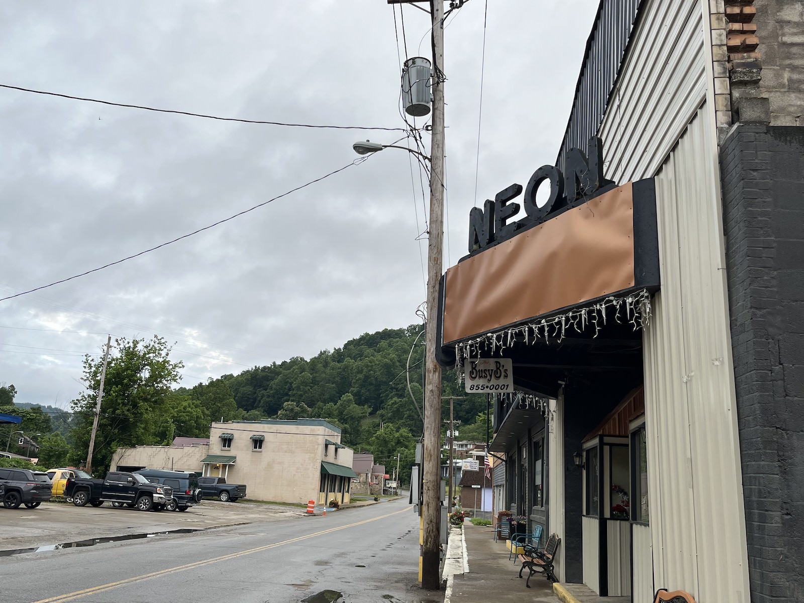
a sign says neon above an awning
A sign hangs above Neon’s main street.
Grist / Katie Myers

Some folks, through persistence, hard work, and a bit of luck, have moved into new homes.

Linda and Danny Smith got theirs from Christian Aid Ministries, a Mennonite disaster relief group, though construction started a couple months later than planned because it ended up taking awhile to figure out exactly where the floodplain was. It was built on their land at the end of a Knott County road called, whimsically, Star Wars Way. According to the Smiths, the group, which was from out of state, nearly ran out of time before having to return home and only just finished the job before leaving. They left so quickly that Danny Smith said he still needed to paint the doors. He isn’t complaining, though. Other homes were left half-done, their new owners left searching high and low for someone to finish the job. 

Although grateful for the help that put a roof over his head, Smith got a little tired of dealing with all the people who came to heal his body, his spirit, and his mind even as he completed mounds of paperwork and made calls to anyone he thought might help. “One guy, he kept insisting that I needed to go talk to someone,” he recalled. “And I said ‘who?’”

a man in woman stand in a kitchen
Linda and Danny Smith stand in the kitchen of their new home. Parker Hobson

The man suggested that Danny talk to a therapist. He laughed at the recollection. It was a laugh heard often around here, the sound of a tired survivor who’s already assessed their own hierarchy of needs many times over. “I said, ‘You know, I don’t need nothing done with my mind. I need a home.”

Despite the frustration, the Smiths are piecing their lives back together, a little bit higher up off the ground than they were before. Christine White is praying for a similar outcome, and thinks she can finally see it on the horizon. The occasional nightmare aside, she’s felt pretty good these days.

FEMA gave her $1,900 awhile back to demolish her house and closed her case, leaving her high and dry. She called housing organization after housing organization until CORE, a national nonprofit that assists underserved communities, agreed to build a small home on a piece of land she owns in Floyd County. Construction began earlier this month. White, who spends her time volunteering at a local food bank, calls it a miracle. “You just gotta go where the Lord leads you,” she says. But it’s not built yet, so she’s trying not to count her chickens.

Parker Hobson contributed to this story.

This story was originally published by Grist with the headline Old nightmares and new dreams mark the year since Kentucky’s devastating flood on Jul 27, 2023.

Latest Eco-Friendly News

Mercury pollution is worsening a mental health crisis in this Indigenous community

Mercury poisoning among members of the Grassy Narrows First Nation in Ontario, Canada, is contributing to high rates of attempted suicide among Indigenous youth. That’s according to a new study out of the University of Quebec in Montreal published this month in the journal Environmental Health Perspectives. 

The study analyzed data from 162 children and 80 mothers, parsing data on mercury levels in umbilical cords and hair, as well as from surveys on fish consumption and mental health. Researchers concluded that three generations of mercury exposure are linked to today’s youth attempted suicide rates.

Donna Mergler, professor emerita at the University of Quebec in Montreal and lead author of the study, said she and her co-authors found that women from Grassy Narrows who ate a lot of fish during pregnancy were more likely to have children with both emotional and behavioral problems.

“It’s like a cascade of effects from the grandparents down to the children,” Mergler said.

Attempted suicide rates are three times higher among Grassy Narrows First Nation members than other First Nation communities in Canada. Suicide rates for First Nation members in Canada are higher than rates for non-Indigenous people as a whole.

In the 1960s and ’70s, the Reed Paper mill dumped nearly 10 tons of mercury into the river the Grassy Narrows First Nation relies on for fish, according to a 2016 report from Canadian broadcaster CBC, which described the pollution as one of the nation’s worst environmental disasters. The study is the latest in a decades-long effort by the community to grapple with ongoing consequences of industrial pollution on their food. 

“We’re very saddened by the report, but it’s also confirmed what we’ve been fearing all along, the impacts of mercury on our people,” Grassy Narrows First Nation Chief Rudy Turtle said at a recent press conference. “The impacts of mercury have been very devastating in terms of our economy. Our way of life has been totally destroyed.”

High mercury exposure has long been associated with brain damage and other neurological problems. In the United States, pregnant women are discouraged from eating high-mercury fish to protect their fetuses. The bigger the fish, the more likely they’ll have lots of mercury as the substance bioaccumulates. 

In 2016, the Toronto Star reported that mercury levels in walleye fish in Clay Lake were 90 times higher than the recommended levels of daily intake for pregnant women set by the U.S. Environmental Protection Agency. Grassy Narrows First Nation members have traditionally fished from the lake and the river it feeds into, with many working as fishing guides for tourists prior to the discovery of the mercury pollution. 

Sarah Rothenberg, an associate professor at Oregon State University’s College of Public Health and Human Sciences, wrote in Environmental Health Perspectives that Mergler’s study is rare in examining the link between mercury exposure and children’s mental health, but said Grassy Narrows is far from the only community facing such challenges. 

Communities living in the Arctic and communities exposed to artisanal and small-scale gold mining may be experiencing mercury exposure, and the potential for similar effects there warrants further investigation, she said. 

Mergler said the study lends scientific evidence to Grassy Narrows’ calls for adequate health care, compensation and a ban on mining and forestry in their territorial lands. In 2020, the federal government promised funds to build a mercury care home but that hasn’t yet materialized. 

Chief Turtle from Grassy Narrows said after the discovery of high mercury levels in the area, commercial fishing companies and lodges closed, spiking unemployment. Still, as per their traditions, his community continues to fish the area for subsistence. 

“It’s just not the same prior to mercury being dumped into our river,” he said.

If you or someone you know may be considering suicide, contact the 988 Suicide & Crisis Lifeline by calling or texting 9-8-8, or the Crisis Text Line by texting HOME to 741741.

This story was originally published by Grist with the headline Mercury pollution is worsening a mental health crisis in this Indigenous community on Jul 27, 2023.
Latest Eco-Friendly News

Gulf Stream Could Collapse Between 2025 and 2095, Bringing Disastrous Climate Impacts, Study Finds

The Gulf Stream is a strong current of warm water that flows from the Gulf of Mexico into the Atlantic Ocean, and runs from the East Coast of the United States across the Atlantic and north past Western Europe. Without the Gulf Stream, which is part of the Atlantic Meridional Overturning Circulation (AMOC), a system of ocean currents that is vital to Earth’s climate, places like England would be much colder.

A new study by Susanne Ditlevsen and Peter Ditlevsen, researchers with the University of Copenhagen in Denmark, has concluded that the AMOC is at risk of collapsing around mid-century, much earlier than scientists had previously thought.

“The Atlantic meridional overturning circulation (AMOC) is a major tipping element in the climate system and a future collapse would have severe impacts on the climate in the North Atlantic region,” the authors wrote in the study. “We estimate a collapse of the AMOC to occur around mid-century under the current scenario of future emissions.”

In the study, the researchers conclude that there is a 95 percent probability that “a transition of the AMOC” will happen around 2025 to 2095.

Consistent measurements of the AMOC have not been ongoing for very long.

“The AMOC has only been monitored continuously since 2004 through combined measurements from moored instruments, induced electrical currents in submarine cables and satellite surface measurements. Over the period 2004–2012, a decline in the AMOC has been observed, but longer records are necessary to assess the significance,” the study said.

The study, “Warning of a forthcoming collapse of the Atlantic meridional overturning circulation,” was published in the journal Nature Communications.

For the study, the researchers looked at North Atlantic sea surface temperatures south of Greenland from 1870 to 2020. Peter Ditlevsen said the area of the ocean they analyzed is warmed by the Gulf Stream, “so if it cools, it’s because the AMOC is weakening,” reported CNN. The pair of researchers took into account how human-caused global warming had influenced the water temperature and subtracted those impacts.

The researchers detected early signs of crucial changes in the AMOC, and Peter Ditlevsen said the collapse of the powerful complex system of currents was most likely to occur between 2039 and 2070.

“It’s really scary,” Ditlevsen told CNN. “This is not something you would lightly put into papers… we’re very confident that this is a robust result.”

The strength of the AMOC currents are reliant upon a balance of water salinity and temperature, but as ocean temperatures increase and the planet’s ancient ice melts, more freshwater is released into the ocean, reducing its density and ability to sink and cause currents. When ocean waters become too warm, too fresh, or a combination of the two, it dramatically affects currents like the Gulf Stream.

The rapid melting of glaciers has caused the AMOC to stop before, but it’s been more than 12,000 years. When it did, within a decade temperatures in the Northern Hemisphere oscillated from 18 to 27 degrees Fahrenheit.

“There is still large uncertainty where the Amoc tipping point is, but the new study adds to the evidence that it is much closer than we thought,” said Stefan Rahmstorf, a climatologist, oceanographer and Professor of Physics of the Oceans at the University of Potsdam in Germany, as The Guardian reported. “A single study provides limited evidence, but when multiple approaches have led to similar conclusions this must be taken very seriously, especially when we’re talking about a risk that we really want to rule out with 99.9% certainty. Now we can’t even rule out crossing the tipping point in the next decade or two.”

The post Gulf Stream Could Collapse Between 2025 and 2095, Bringing Disastrous Climate Impacts, Study Finds appeared first on EcoWatch.

Latest Eco-Friendly News

Florida Waters Reach Hot Tub Temperatures of 101.19 Degrees Fahrenheit

Earlier this week, south Florida saw sea surface temperatures equivalent to a normal hot tub. At Manatee Bay, inside Everglades National Park, a water temperature buoy about five feet underwater showed a temperature of 101.19 degrees Fahrenheit on Monday afternoon, with other buoys in the vicinity reaching 100 degrees Fahrenheit, reported AFP and Reuters.

Manatee Bay is located about 38 miles southwest of Miami.

According to the National Oceanic and Atmospheric Administration (NOAA), this time of year normal south Florida water temperatures should be from 73 to 88 degrees Fahrenheit, The Guardian reported.

“As far as all of our bay waters, any near-shore waters, everything is super, super hot,” Dustin Hansel, a fishing boat captain in Key Largo, Florida, told Reuters.

Weather monitors around the world have been warning about the influence of such warm waters on extreme weather events, as well as on marine ecosystems like coral reefs.

“We didn’t expect this heating to happen so early in the year and to be so extreme,” Derek Manzello, a coordinator at the NOAA’s Coral Reef Watch, told CNN. “This appears to be unprecedented in our records.”

Sea surface temperatures in the waters of south Florida stayed above 100 degrees Fahrenheit for about four hours on Monday, according to AFP.

The 101.19 degrees Fahrenheit temperature might have set a sea surface temperature world record, but a tweet from meteorologist Jeff Masters, a former government scientist, said “contamination of the measurement by land effects and organic matter in the water might… invalidate the record. Unless there is photographic proof that debris was not present, it would be difficult to (verify) the 101.F record as valid,” as reported by AFP.

Land and sea surface temperature records have been broken as heat waves and wildfires plague countries around the world, from Italy to China.

According to Spain’s Institute of Marine Sciences, the Mediterranean Sea saw a record high temperature of 83.678 degrees Fahrenheit on Monday, Le Monde with AFP reported.

Experts have said current heat waves are expected to continue through August, with the extreme temperatures being fueled by human-caused climate change, reported Reuters.

Record high sea surface temperatures are being affected in part by El Niño.

Increased sea surface temperatures in Florida could add to the severity of hurricanes and tropical storms as they move over the warmer waters. “We are seeing unprecedented changes all over the world,” said NASA climatologist Gavin Schmidt, as AFP reported.

The post Florida Waters Reach Hot Tub Temperatures of 101.19 Degrees Fahrenheit appeared first on EcoWatch.

Latest Eco-Friendly News

Report: 41 million Americans are simmering on urban heat islands

Try walking outside on a midsummer day in New York City. You’re sweating buckets. You can smell garbage rotting by the side of the road. The sunlight and heat seem to reflect from the steaming pavement, which is so hot to the touch it burns your skin. 

That’s an example of the urban heat island effect – a well-known phenomenon in which cityscapes, particularly those without much in the way of trees or shade, tend to amplify and reflect heat, turning temperatures up by a magnitude of 8 degrees or higher. It can cause public-health problems in any city, making people sick with deadly heat exhaustion and heatstroke.

A study out Wednesday from Climate Central, a nonprofit research organization, analyzed the urban heat island index of 18,945 census tracts in 44 major U.S. cities, home to nearly a quarter of the country’s population, breaking the data down by neighborhood to show “heat maps” of the cities involved. It’s not only a piece of research, but also potentially a tool cities could use to identify environmental inequities and target investment in order to solve them.

In particular, urban neighborhoods in large cities like New York, Chicago, San Francisco, and Miami were vulnerable to the worst of the urban heat island effect. Overall, nine cities have more than 1 million people at risk of having to endure an extra 8 degrees because of the heat island effect; across all 44 cities in the study, the tally is 41 million.

Peter Girard, the vice president of communications at Climate Central, says the “heat maps” should be used as a tool for solutions. There are simple fixes: more tree cover and vegetation, lighter paint on rooftops, rooftop gardens, and other measures can reduce the urban heat island effect and make cities both more bearable and more pedestrian friendly. 

This study comes on the heels of the hottest June as well as the hottest days and weeks in recorded history, with deadly heat domes stagnant over much of the world, including the U.S. Southwest. Cities like Phoenix, are currently experiencing temperatures over 110 degrees Fahrenheit, and the heat is killing people.

Though the study does not specifically discuss the long-term effects of race and class discrimination on the urban heat island effect, Girard says it’s an important part of the discussion.

“The hottest spots in these cities … are very, very frequently associated with black and brown, low income communities – people with social vulnerability,” said Girard.

According to the Environmental Protection Agency, historic redlining is associated with urban heat islands today. Reducing inequities could mean investing in green space, creating more shade, and using “cool pavement,” a technology being piloted by the city of Phoenix, Arizona.

And there’s one big thing people can do to reduce the heat island effect, Girard said. “The only real solution is reducing global warming altogether.”

This story was originally published by Grist with the headline Report: 41 million Americans are simmering on urban heat islands on Jul 26, 2023.

Latest Eco-Friendly News

Deadly Wildfires Spread Across the Mediterranean

Wildfires are spreading in nine Mediterranean countries, killing dozens of people and causing thousands to evacuate. Heat waves and dry vegetation have created conditions for the wildfires to spread, and the extreme heat has been made more likely because of climate change, scientists say.

Algeria has experienced the highest death toll of 34 people, as the BBC reported. Temperatures in Algeria have reached around 122 degrees Fahrenheit (50 degrees Celsius), The Guardian reported, and witnesses to the wildfires described them as being “like a blowtorch.”

Parts of Rhodes, a Greek island, have been evacuated because of the wildfires, with more than 20,000 people fleeing, and others have had to evacuate from Sicily and Puglia in Italy and Melloula in Tunisia. 

“I will state the obvious: in the face of what the entire planet is facing, especially the Mediterranean which is a climate change hot-spot, there is no magical defense mechanism, if there was we would have implemented it,” Greek Prime Minister Kyriakos Mitsotakis said.

Two pilots who were working to control flames in Greece using water-dropping planes died when the plane crashed into a hillside, Reuters reported. More than 600 firefighters were tasked with putting out a wildfire near Lisbon, Portugal, and about 130 firefighters were handling a fire near Dubrovnik, Croatia that had caused landmines to explode.

Firefighters in Italy have worked on about 1,400 fires from Sunday to Tuesday, most of which were in Sicily and Calabria. As The Local reported, Renato Schifani, regional president of Sicily, was planning to ask the Italian government to declare an emergency on Wednesday during the ministers’ meeting.

In addition to the fires in the southern part of the country, northern areas of Italy have experienced deadly 70 mph (110 kmh) winds, tornadoes, torrential rain and hail. The storms have killed multiple people, including a 16-year-old girl who was on a summer camping trip.

“We are experiencing in Italy one of the most complicated days in recent decades — rainstorms, tornadoes and giant hail in the north, and scorching heat and devastating fires in the center and south,” Civil Protection Minister Nello Musumeci said, as reported by the BBC.

The extreme temperatures and dry conditions, as well as the resulting wildfires, have been made more likely by human-caused climate change, said a study from World Weather Attribution.

“Unless the world rapidly stops burning fossil fuels, these events will become even more common and the world will experience heatwaves that are even hotter and longer-lasting,” World Weather Attribution said in a statement.

The post Deadly Wildfires Spread Across the Mediterranean appeared first on EcoWatch.

Latest Eco-Friendly News

Alaska is facing a massive mineral boom, but at what cost?

This story was co-published with Alaska Public Media.

A dusting of snow clings to the highway as Barbara Schuhmann drives around a hairpin curve near her home in Fairbanks, Alaska. She slows for a patch of ice, explaining that the steep turn is just one of many concerns she has about a looming project that could radically transform Alaskan mining as the state begins looking beyond oil.

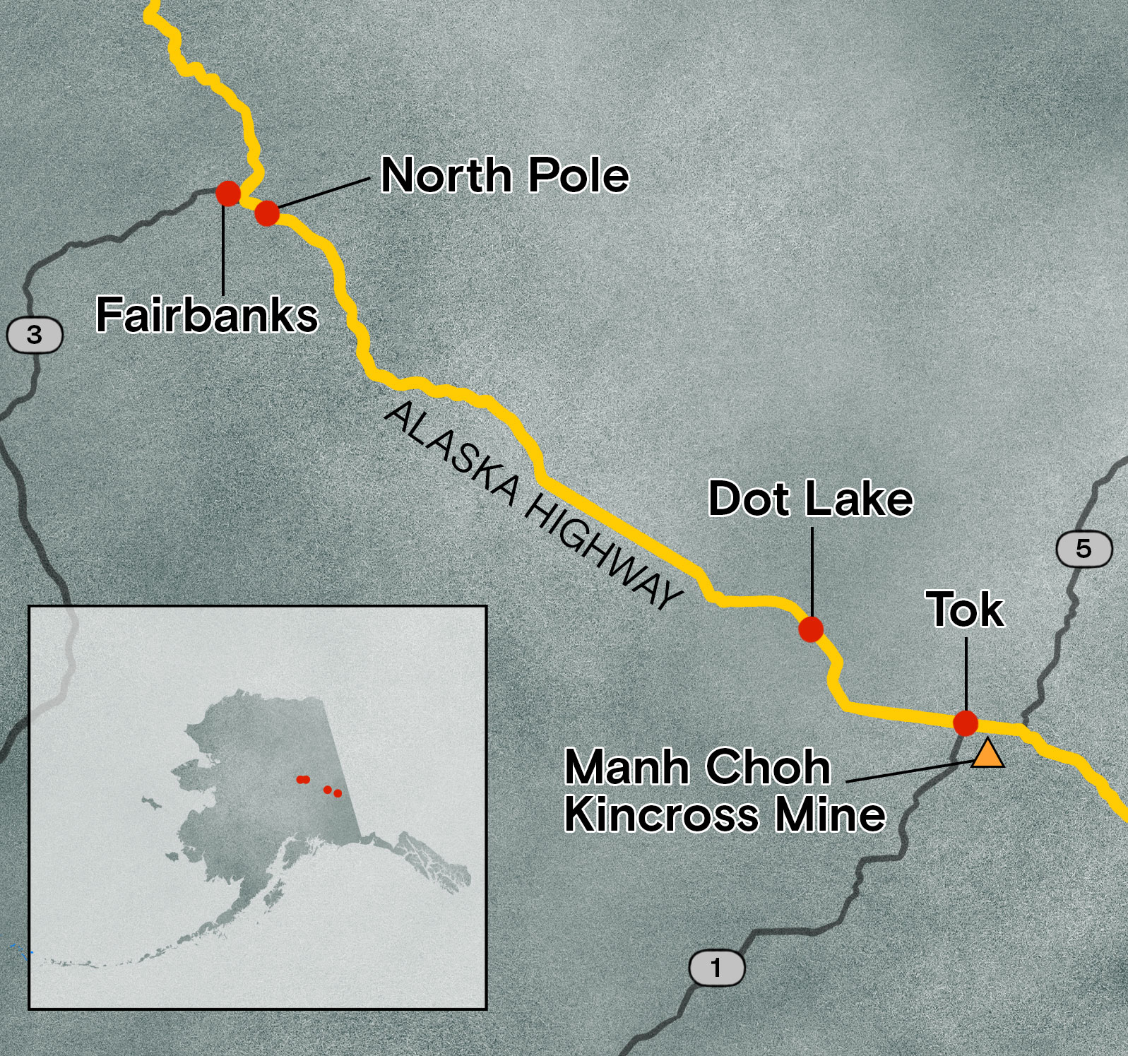
Roughly 250 miles to the southeast, plans are developing to dig an open-pit gold mine called Manh Choh, or “big lake” in Upper Tanana Athabascan. Kinross Alaska, the majority owner and operator, will haul the rock on the Alaska Highway and other roads to a processing mill just north of Fairbanks. The route follows the Tanana River across Alaska’s interior, where spruce-covered foothills knuckle below the stark peaks of the Alaska Range. Snowmelt feeds the creeks that form a mosaic of muskeg in nearby Tetlin National Wildlife Refuge, a migration corridor for hundreds of bird species. 

two birds fly over a snowy lake
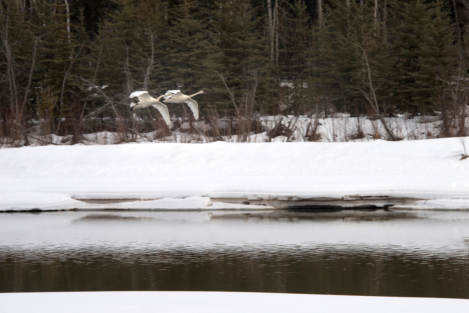
Trumpeter swans land on the Chena River near a bridge on Peger Road. Eighty-ton trucks will soon be driving across it as part of Kinross’ 250-mile ore haul. Grist / Sean McDermott

When Schuhmann first heard about the project about a year ago, she was surprised. Kinross’ contracted trucking company, Black Gold Transport, will use customized 95-foot tractor-trailers with 16 axles, which will weigh 80 tons apiece when fully loaded. These trucks will soon rumble by homes and businesses every 12 minutes, 24 hours a day, seven days a week, with trial runs starting this summer. “It sounded pretty crazy at the time, moving a mountain from one area of Alaska to another,” she recalls. “It just seemed unbelievable that this would be allowed without special permitting and safety considerations.”

She doesn’t often bring it up, but Schuhmann knows just how dangerous the road can be. Her husband lost his mother, brother, and sister on that highway when a truck crossed the centerline, hitting their car head-on. “So, accidents happen,” she says.

a woman's face in the side view mirror of a car
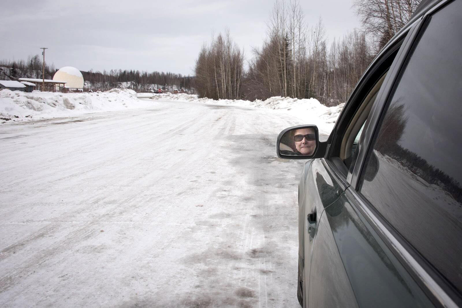
Barbara Schuhmann’s face reflects out of the side-view mirror while parked on a stretch of road on the haul route just north of Fairbanks. Grist / Sean McDermott

The risks go beyond traffic. The mine and its tailings at Fort Knox, the state’s largest gold mine, have the potential to pollute the air and waterways. But unlike most other mines in the state, there has been no environmental impact statement prepared for Manh Choh. Residents in communities along the route worry about the increased violence and housing shortages that often follow the arrival of such projects. Others question the state’s ability to impartially oversee the permitting process when it has invested $10 million from a state fund in the mine. 

Kinross, which declined repeated interview requests and told others not to speak to Grist, says the project will create more than 400 jobs. Supporters point to the economic boost it could bring to the Native Village of Tetlin, which is leasing the land to Kinross, as well as to nearby Tok, home to 1,200 people

But Manh Choh is just the beginning of a surge in mining projects in the state. While gold is not a critical mineral, Alaska holds large reserves of cobalt, copper, and rare earth minerals essential to the green transition. If Kinross is allowed to use public roads, it will set a precedent for other companies eager to expand — one in which significant health and safety risks are underwritten by taxpayers. Other looming projects, like the planned Ambler Road in the Brooks Range, are already quietly preparing to use the state’s highways. 

Grist

Alaska is at a pivotal moment: Oil and gas production, historically the most important driver of the state’s economy, has been declining for decades. Mining, meanwhile, saw a 23 percent increase in production value in 2021 alone. As the Biden administration pushes to shore up domestic supply chains, Alaskans like Schuhmann aren’t the only ones questioning the race for minerals. She worries the state hasn’t taken the time to make sure that Alaskans can benefit from this kind of development — or at the very least, won’t be harmed by it. “They can’t answer the questions,” Schuhmann said. “And so we just keep trying to ask them.”


Lynn Cornberg adjusts her skis, tucking her chin into the wind. She sets off on a historic trail, just north of where gold was first discovered in Fairbanks in 1902, earning it the nickname “The Golden Heart City.” Spindrifts kick up behind her, crystalline in the below-zero chill. The snow darkens with dust as she approaches Fort Knox, where the original gold deposit is running out. After investing so much in the mine’s mill, however, Kinross is eager to keep it running by processing ore from other sites. 

a woman in a blue snow jacket and skis stands on a snowy hill
Fairbanks resident Lynn Cornberg stands at an overlook near the Fort Knox mine, Alaska’s largest gold mine. She says she is concerned about the impact of the ore haul and the introduction of potentially acid-generating tailings to Fort Knox mine. Grist / Sean McDermott

The rumble of huge machinery booms through the forest as the wind whips downhill toward Cornberg’s house. She worries about the risks the rock arriving from Tetlin might pose for her family. In addition to carcinogenic heavy metals, Manh Choh’s ore has the potential to generate acid. Such toxic effluent can continue for millenia. “It goes on generating acid forever,” Schuhmann says. “When you expose this sulfide to the air, it oxidizes. With a little precipitation, it turns to sulfuric acid that kills fish.” This pollution could be a problem not only at the pits in Tetlin, but from dust raised while crushing or transferring the ore to trucks; from whatever blows out of the big rigs on the road; or from processing, stockpiling, or storing the tailings at Fort Knox. 

Stanley Taylor, the environmental coordinator for the Native Village of Tetlin, says some village residents were concerned about the risks, and the tribe intentionally outsourced some of the potential hazards to Fort Knox. As the Tetlin Tribal Council wrote in a letter to the Army Corps, “This plan only works because it uses existing infrastructure, the public highway system, and the mill at Fort Knox.” (Tetlin’s chief, Michael Sam, and its tribal council declined repeated interview requests.)

Given these concerns, the project’s environmental review has recently come under scrutiny. Permitting for Manh Choh falls to different state and federal agencies, and there has been no comprehensive look at the project’s full scope. When Fort Knox was first developed in 1993, Kinross conducted an assessment that did not require independent expert review, like an environmental impact statement would have. The permit issued then provided an umbrella for several other mines developed since, with few public details about their operations. Due to Fort Knox’s geochemistry, no one anticipated acid generation. Now, with Manh Choh, “I don’t think any of us [at the Corps’ Alaska district] considered that as a potential impact, that they’re bringing a different type of ore to the mill,” says Gregory Mazer, the project manager for the Army Corps of Engineers.

The Corps’ own review focused on a 5-acre area of wetlands around Manh Choh that did not include the trucking corridor and the tailings at Fort Knox. Both the Environmental Protection Agency, or EPA, and the U.S. Fish and Wildlife Service criticized that decision. The EPA pointedly noted that many other hard-rock mine projects in Alaska have required an environmental impact statement, which “established a precedent which we recommend be considered.” It also suggested that “this project would greatly benefit from a more thorough review.” Both agencies warned about mercury, arsenic, and other heavy metals contaminating waterways, and about the mine’s effect on wildlife, including salmon that spawn in nearby waterways like the Tanana and Tok rivers. 

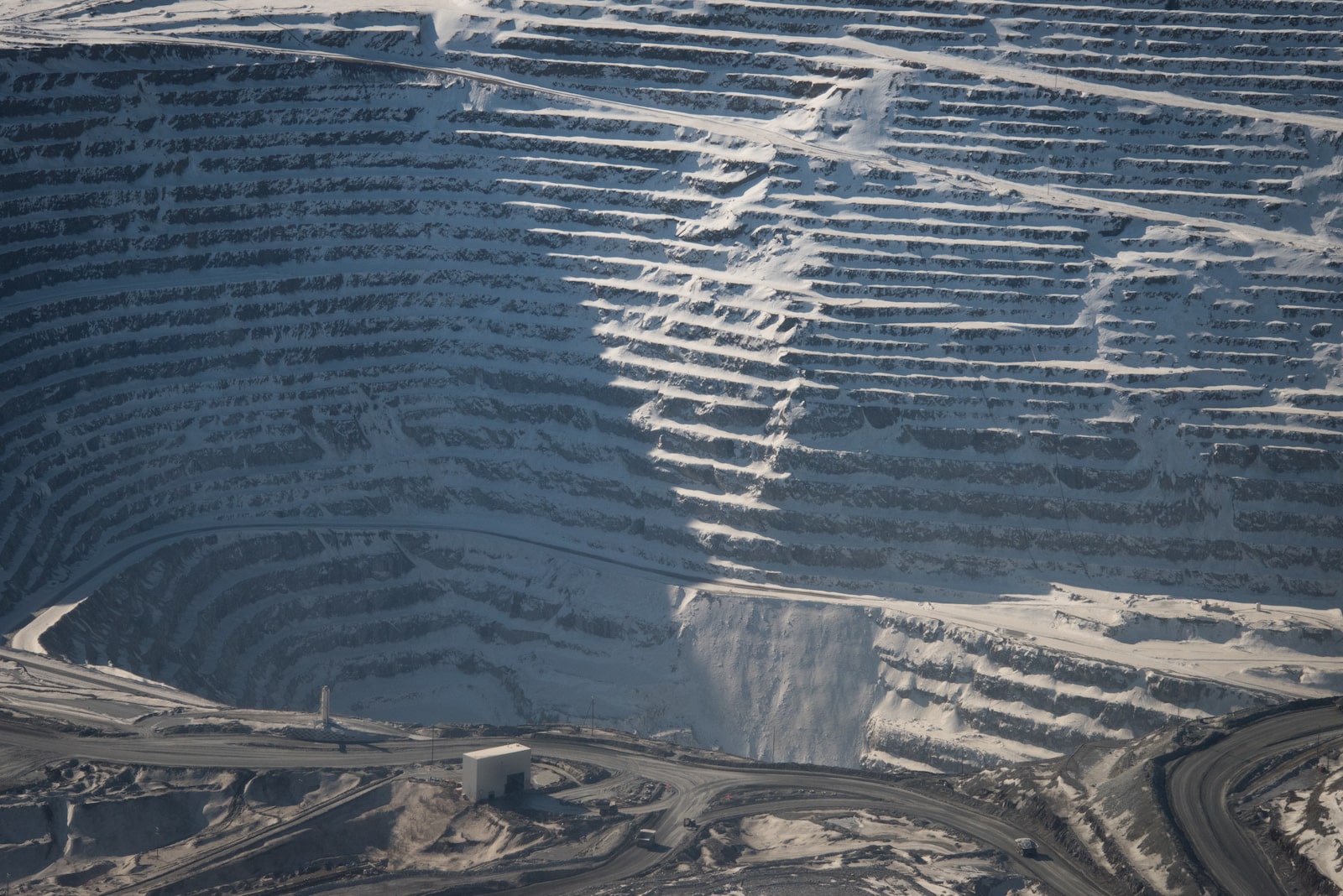
grooves cut into snowy ridges as part of a mine
An aerial view of the existing Fort Knox mine, where ore from Manh Choh will be processed. Grist / Sean McDermott

This strategy is known as segmentation, or “dividing up projects so that each little facet of it would have no significant impacts,” says Robin Craig, a professor at the University of Southern California Gould School of Law. “Normally tailings are part of a mining permit,” she says dryly, and “historically in Alaska, tailings affect water quality.” A recent analysis of court cases by environmental law professors at Lewis & Clark Law School argues that the Corps’ pattern of narrowly reviewing projects is inconsistent with the agency’s own National Environmental Policy Act regulations. “Alaska is kind of infamous for letting mining go, regardless of the environmental impacts,” Craig says.

When Schuhmann filed a federal record request in the winter of 2022, for example, she learned that even the agencies involved in the mine’s permitting didn’t have all the information needed to assess its impacts. Kinross had given the Army Corps of Engineers a geochemical report detailing Manh Choh’s potential for acid generation — but experts at U.S. Fish and Wildlife didn’t know about it until Schuhmann gave it to them.

The state Department of Natural Resources routinely publishes links to permits, leases, and environmental audits for other mines, but Schuhmann was the first to share the documents publicly. “I have never considered myself an environmentalist. I mean, my whole working life, I was trying to help people develop their property,” she says. But now, “I am flabbergasted.” 

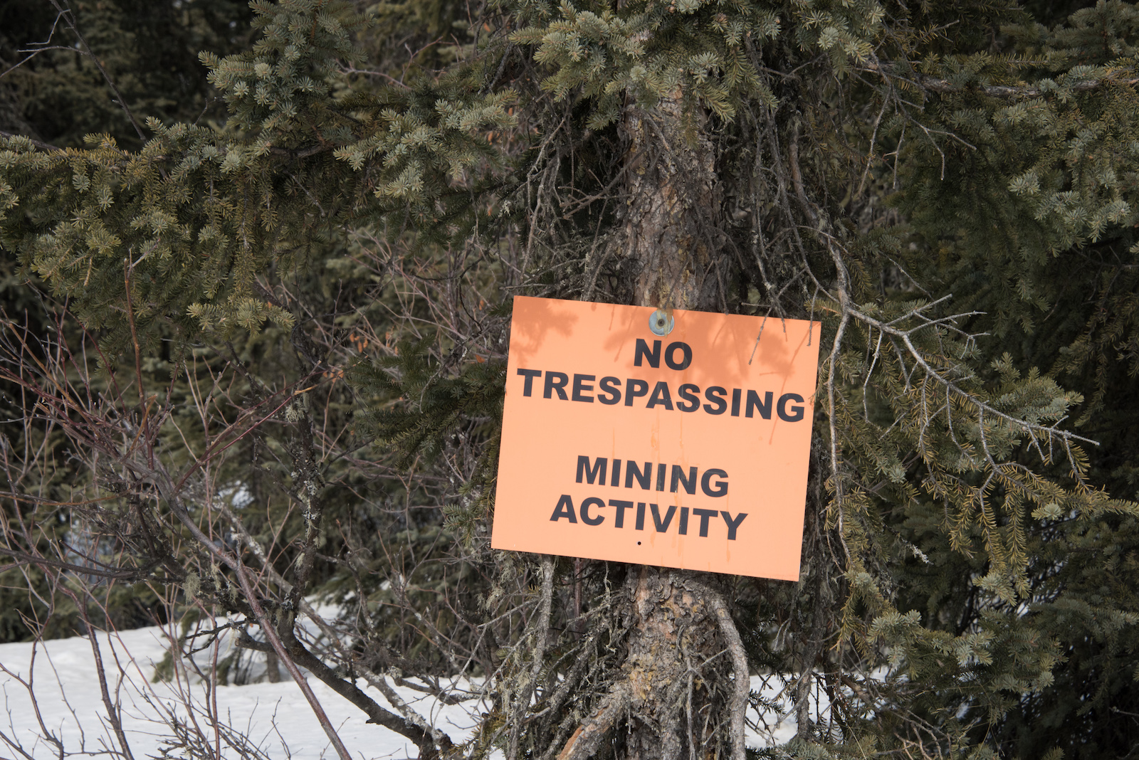
an orange sign says no trespassing, mining activity
A “No Trespassing” sign stands outside of the Fort Knox mine along a public ski and snow machine trail. Grist / Sean McDermott

Despite these concerns, Kinross is only required to monitor for acid generation for five years after mining is completed, after which the state will review its condition — a period Craig says is far too short for a problem that can last thousands of years. (The Department of Environmental Conservation says it is limited by state regulations to five-year permits.) Unlike many of the Western states now struggling to deal with acid leaching, she adds, “Alaska is actually in a position to prevent future, lingering, avoidable harm.”

But the state, which has invested $10 million in Manh Choh via Kinross’ junior partner Contango ORE, has been very supportive of the project. One of the trustees involved in managing that state fund, Jason Brune, also leads the agency responsible for issuing Kinross’ waste management permit. (In March, Alaska’s Permanent Fund Corporation board of trustees banned in-state investments to avoid future conflicts of interest.) “Regulatory agencies follow the politics of the administration they work for,” says Dave Chambers, founder of the Center for Science in Public Participation, a nonprofit that provides technical assistance on mining.

And in Alaska, the current administration is decidedly pro-development, a point Governor Mike Dunleavy — who fired an employee for refusing to sign a loyalty pledge — made in an interview with the Fairbanks Daily News-Miner last winter. “There’s too much ‘no.’ No trucks on the road from Tetlin to Fort Knox, no West Susitna Access Road, no Ambler Road,” the governor said. “I need Alaska to say yes to everything.” 

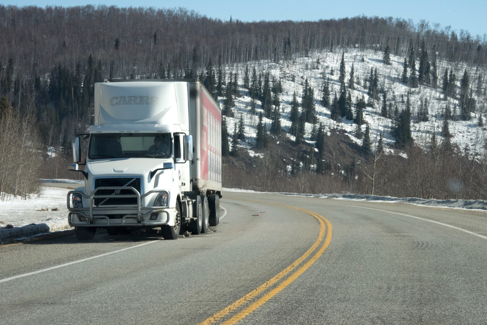
A truck is pulled to the side of the highway for repairs along the road between Fairbanks and Tok that will be used for the ore haul. Grist / Sean McDermott

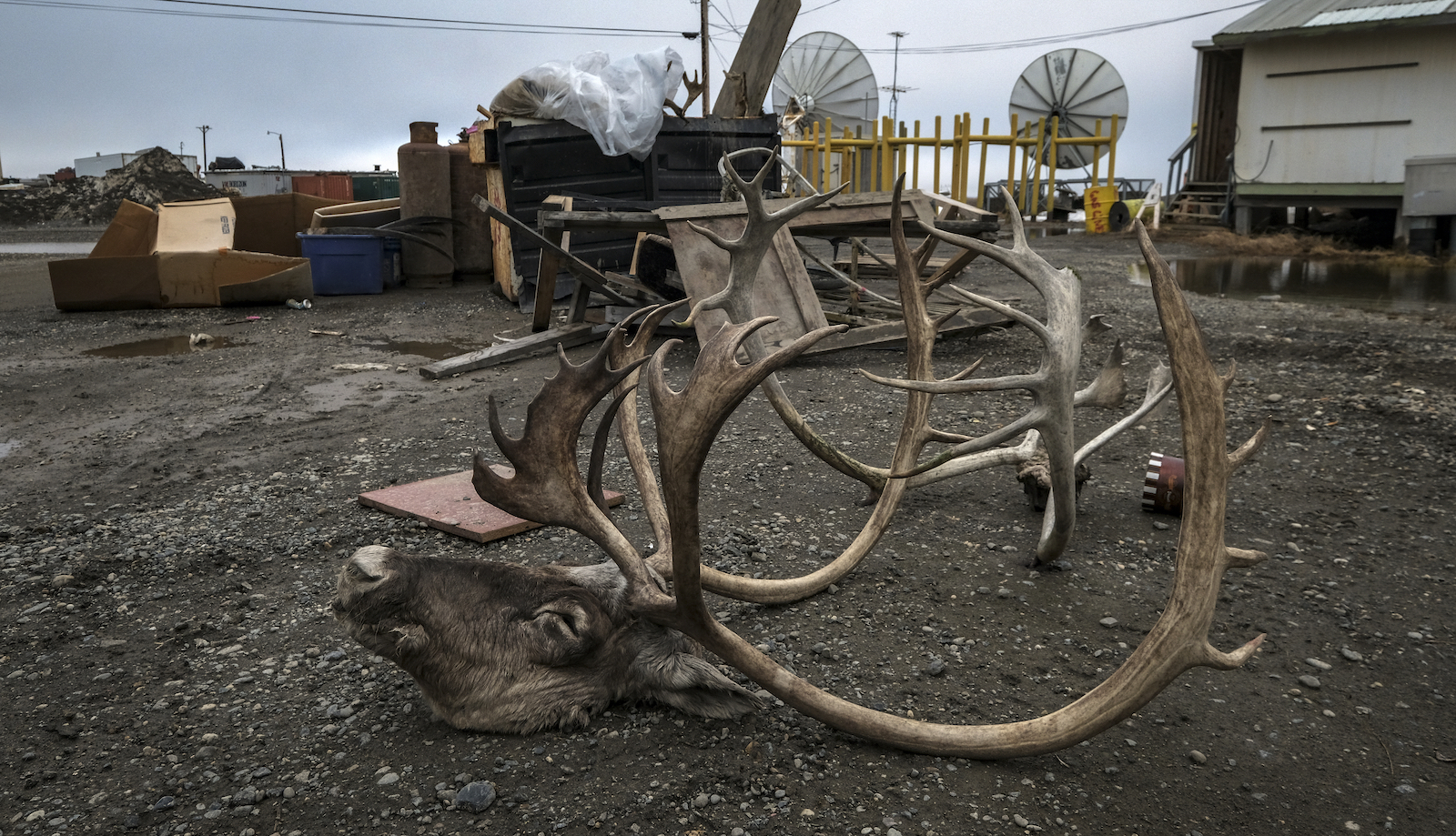
Every year as the ice breaks up across Alaska’s vast Interior, caribou travel from their winter range near Tetlin to their calving grounds. Their tracks crisscross the crust along the highway into Tok, where another kind of migration is under way: White trucks flying orange safety flags zoom into the gas station and pull into Fast Eddy’s, the sole restaurant. Though Kinross isn’t yet processing ore, crews are building a gravel road to the site, where the company has started working. It recently bought a shuttered motel to use as a “man camp,” or employee housing. The wood on its tall, locking fence — built in response to locals’ concerns about the influx of workers — is still raw. 

Down the road, Bronk Jorgensen’s log house offers a view of the hill, bristling with dark trees, that will soon be dug out. He grew up in Tok, flying over old claims in the back seat of his dad’s bush plane. It’s always been a “passing-through town,” Jorgensen explains. Tok began as a camp for the construction of the highway during World War II, and eked out a few more jobs when the Trans-Alaska Pipeline was constructed. Now, it’s a stop along what remains the only road to the Lower 48. “This will be the first real industry this community and area has seen on any scale,” he says. 

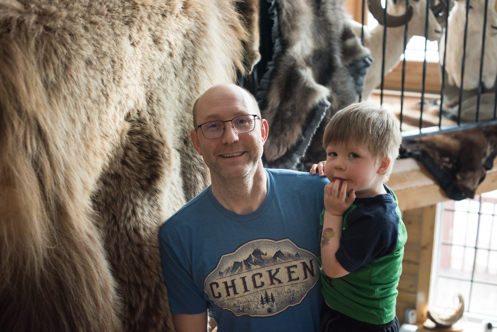
a man holds a small boy and smiles
Bronk Jorgensen poses for a photo at home with his young son. Kinross hired Jorgensen’s company to help construct the road connecting the Manh Choh site to the highway. Grist / Sean McDermott

Jorgensen concedes the increased traffic may be inconvenient, but says gold is a commodity, like any other already carried on the road. “If we as a society want to keep living the lifestyle that we live — between electric cars, iPhones, TVs — you know, we need a lot of minerals,” he says. He works a family placer mine, a small-scale operation that extracts gold from a stream bed, and argues that Alaska has far better safety records and environmental standards than other parts of the world. “If we’re going to be consuming these items, we should be responsible and producing them.”

Given his experience moving equipment into remote locations, Kinross hired Jorgensen’s company to help construct the road connecting the mine site to the highway. “Kinross has been very generous in making sure local contractors have had an opportunity to bid part of the work,” Jorgensen says. “The trickle-down economics of this project is going to be huge.” 

Communities around Tok are hopeful Kinross will offer coveted year-round employment. The Alaska Department of Labor and Workforce Development recently awarded a $300,000 grant to train residents for potential jobs at Manh Choh. But Larry Mark, one of several hundred Tetlin tribal members, says, “What I’d really like to see is the tribal members have the first priority on jobs. We see all the non-tribal members getting hired left and right.” 

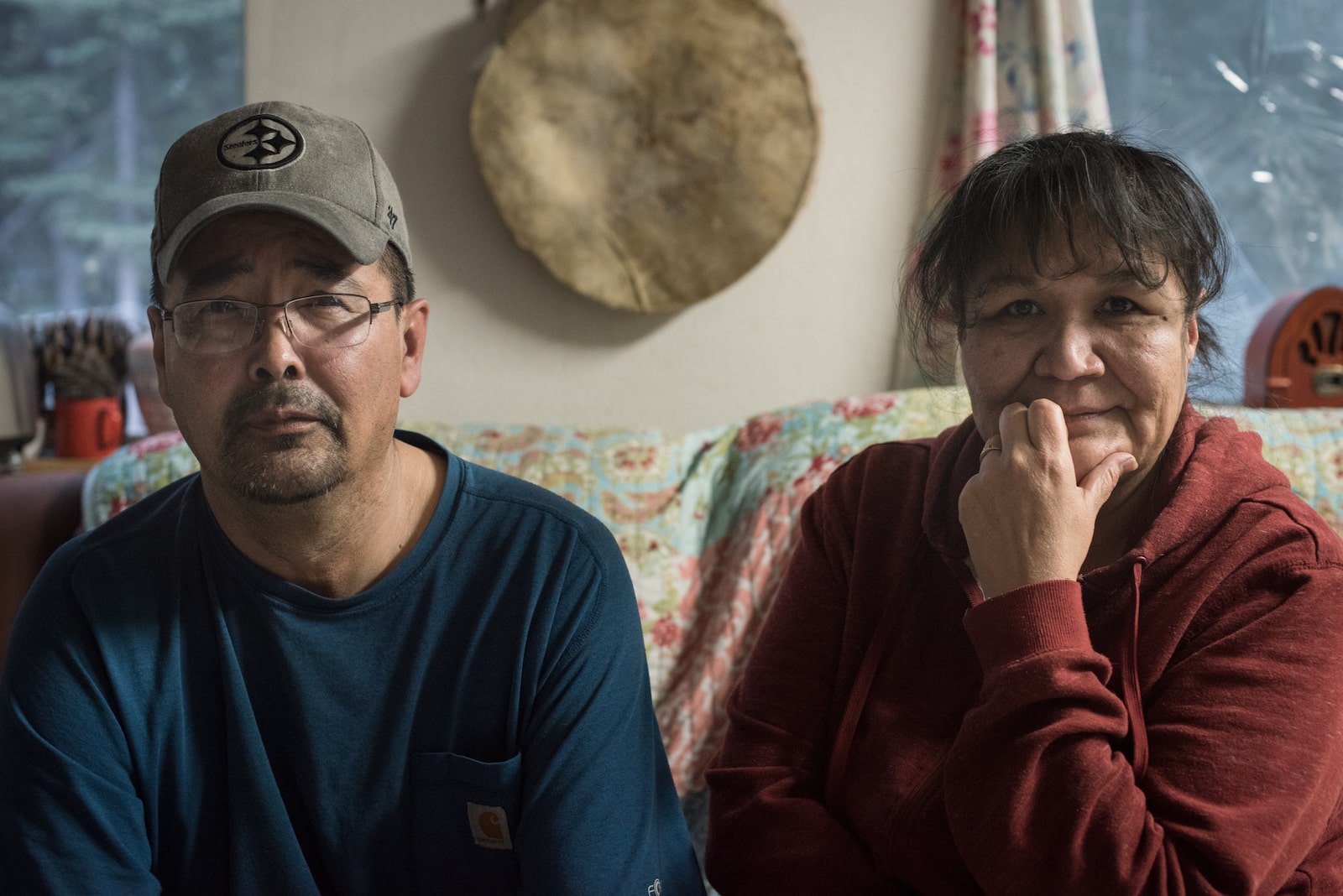
a man in woman sit in a home
Tetlin tribal member Larry Mark, left, sits next to his wife, Shirley. Mark wants the economic benefits from the mine to reach tribal members. Grist / Sean McDermott

Mark also questions the royalties Tetlin will receive from the project, which are set at a range of 3 to 5 percent. Elsewhere in Alaska, similar endeavors often offer much higher rates, as well as partial ownership. Red Dog, for example, is a large zinc mine leased from the Iñupiat in northwest Alaska, who now receive 35 percent of its net profits. Over half of its employees are tribal members.

Tetlin is in a unique position: Unlike other tribes, it retained its subsurface rights under the 1971 Alaska Native Claims Settlement Act, and negotiated the lease of its land to Kinross directly. “You have small communities with limited resources, responding to large companies with unlimited resources. And it’s very much an imbalance,” says Bob Brean, the former president of the native corporation of Tanacross, a tribe to the west of Tetlin. He spent decades negotiating surface deals for Tanacross with multinational companies like ExxonMobil. He learned the hard way to always demand a profit-sharing formula. “Alaska is still subjected to colonization techniques by big industry,” he says.

Though some tribal members remain enthusiastic about what Manh Choh money could bring to Tetlin — where most of the 130 village residents lack running water or sewer systems — Mark doesn’t feel the village is getting its fair share. “You got to benefit the tribe,” he says, frowning, “and it’s got to be in writing.” 

Today, Mark lives in Tok with his adult sons, who come and go as he watches a basketball game, wearing moccasins with a hand-beaded Pittsburgh Steelers logo. “I grew up without electricity,” he says. He learned Upper Tanana Athabascan as his first language, traveled by dog team, and spent his winters trapping. “We’re the richest people there is. We have all the land, we have all the animals — we have everything.”

But Kinross’ bulldozers ran over his traps, costing his family thousands of dollars. Tribal members hunting a moose were recently thwarted by Kinross employees when the animal crossed the company road. Mark worries the ongoing construction will scare away the game his family relies on, especially if Manh Choh is just the beginning of renewed mining in the region. As the price of gold hovers around all-time highs, many old claims, like those scattered through the hill country north of Manh Choh, have become profitable again. “You ever see a miner stop looking for gold?” Mark asks. “They’re going to move to the next hill.”

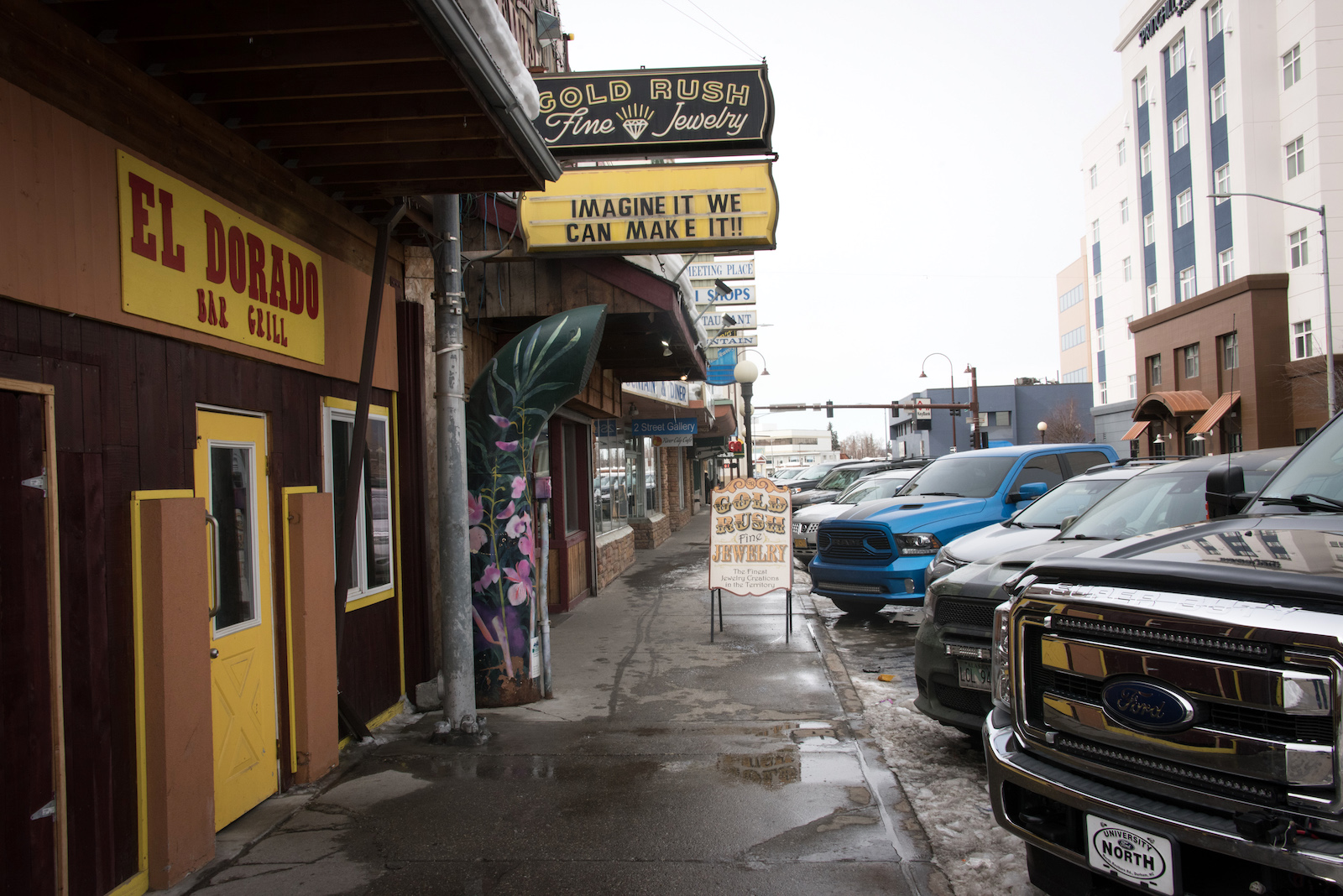
Gold-themed shops and restaurants dot a street in Fairbanks, Alaska. Grist / Sean McDermott

Forty-five minutes west of Tok, over rippling frost heaves and past the skeletons of wildfire, sits the Native Village of Dot Lake. A northern harrier hovers near the small cluster of buildings, its cinnamon belly flashing as it circles, listening for prey. Tracy Charles-Smith, the president of Dot Lake’s tribal council, says Kinross recently asked to speak with the tribe about employment opportunities. She said no. “We don’t have people that want to work in their mine,” she says. “They apparently buy pizza for everybody and whatever. But we can buy our own pizza.”

Traffic blows by Dot Lake’s school at 65 mph. “My tribe is very concerned with cultural and social impacts [of Manh Choh], especially when it has to do with murdered and missing Indigenous women,” Charles-Smith says, citing research that suggests man camps can lead to greater incidences of sexual violence. “We’re pretty much expecting there to be an increase in victims,” she says. The closest hospital that can handle rape cases is 155 miles away in Fairbanks; Charles-Smith says it can take tribal members hours to get there. As a result, Dot Lake is in the process of creating a sexual assault response team. 

Alaska already has an ongoing critical shortage of law enforcement in rural areas, and getting a timely response can be difficult. “The increase in the population alone is going to mean that there’s less opportunity for police to respond,” she says. 

Other safety questions loom over the route as it winds from Tok to the urban centers of North Pole and Fairbanks. It’s primarily a two-lane ribbon of pavement with few passing lanes, and there are no alternative roads — for many, it’s a lifeline to a hospital, airport, or grocery store. The Alaska Department of Transportation and Public Facilities has made plans to fast-track the replacement of five bridges along the way, including two that the agency says are specifically to accommodate the ore haul. The Federal Highway Administration recently took issue with Alaska’s ratings standards for bridges. Alaska is the only state with no maximum load limit, which could result in trucks carrying more than the federal agency allows, possibly damaging structures over time. (The state has agreed to a plan with the federal agency to come into compliance.)

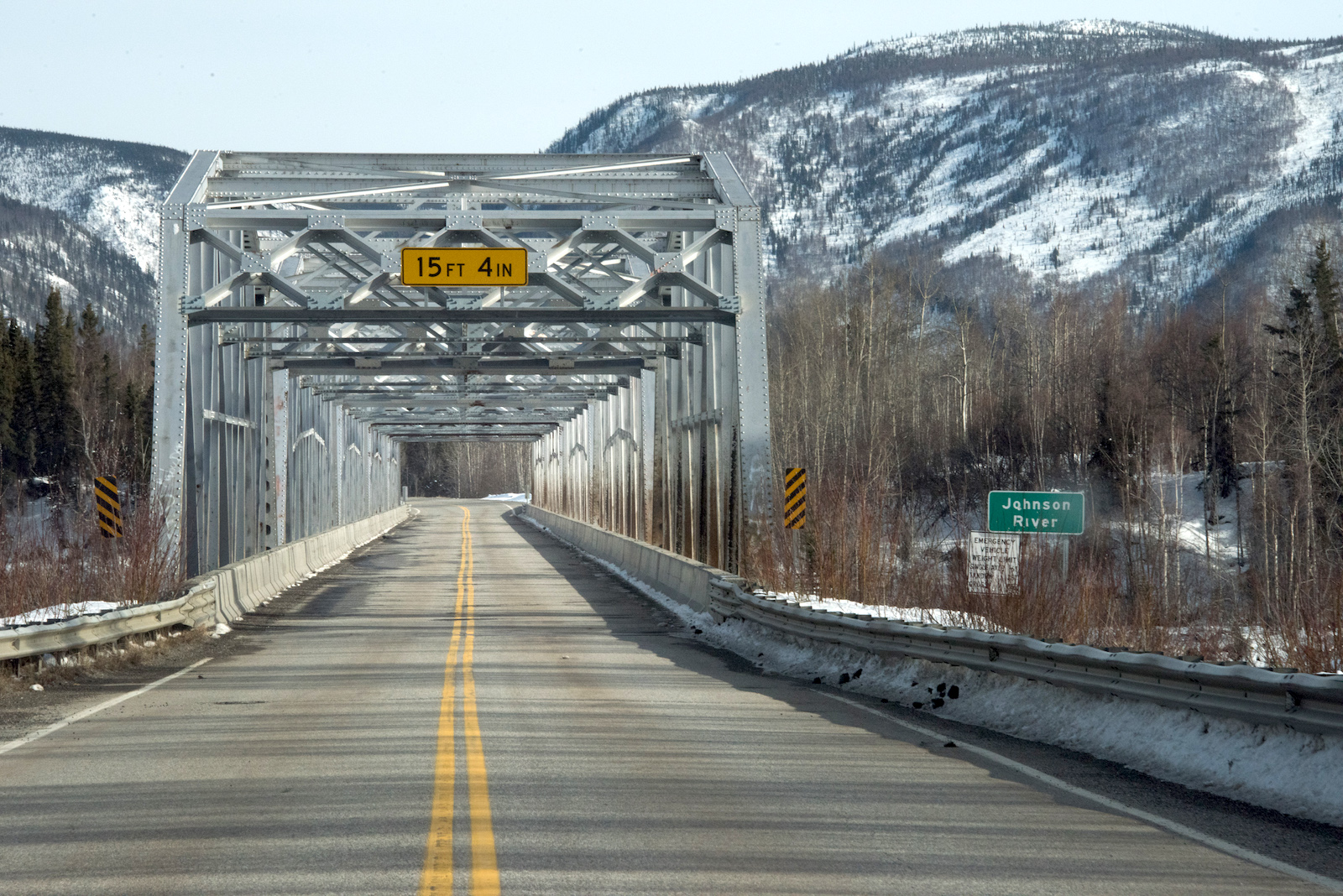
a metal bridge and highway
The Alaska Highway passes over the Johnson River Bridge between Delta Junction and Tok. Grist / Sean McDermott

The DOT brushed away Barbara Schuhmann’s questions about these bridges last fall. During that same timeframe, the agency’s staff was working on a weekly basis with Kinross to provide engineering support for the project. “It’s kind of disconcerting that they’ve worked so hand-in-glove with Kinross, and yet they’re not forthcoming with the public,” Schuhmann says. 

Three of these bridges were built during the 1940s. Their replacements aren’t likely to be completed until 2027. One of them is so narrow that the local custom is to wait for oncoming traffic to clear before starting across. The Department of Transportation places the price of the infrastructure upgrades at more than $317 million. None will be completed before the first trucks roll later this summer, or even before the mine reaches full production next year. 

Retired DOT engineer Bob McHattie, who oversaw this stretch of highway during his decades at the agency, says that based upon his experience with haul roads, ongoing maintenance will add to those expenses — a point the agency concedes. Kinross will increase traffic on the road by as much as 20 percent. “Those big trucks will be the highway traffic between the mine and Fairbanks,” McHattie says. “Those will be the vehicles that are wearing out the road.” In states with less permissive load formulas, he believes, based on his experience, that “it probably wouldn’t be legal.” 

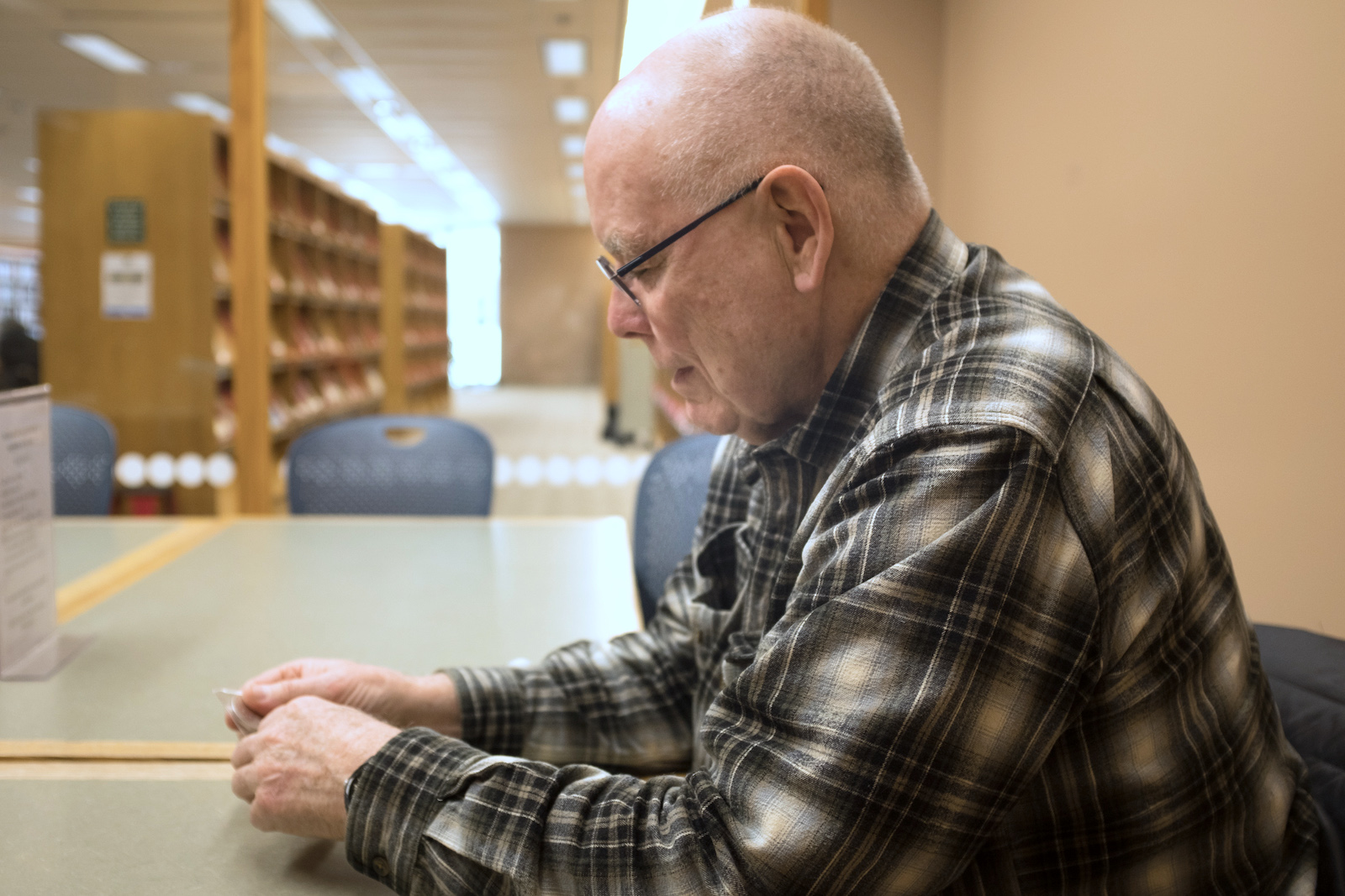
a man in a flannel shirt sits in a library looking at his hands
Retired Department of Transportation engineer Bob McHattie examines a 50-peso coin, which he says contains an ounce of gold. Grist / Sean McDermott

The DOT says it doesn’t know how much this will ultimately cost Alaska, which has a budget crisis. To help pay for safety measures like additional plowing, the DOT could levy a toll on trucks using regulations already on the books. Kinross, meanwhile, has suggested the state increase its fuel tax on the general public.

Feeling like state officials were not taking these concerns seriously, Schuhmann helped form a group called Advocates for Safe Alaska Highways. Its members make unusual allies, with viewpoints spanning the political spectrum. Most, Schuhmann hastens to add, support mining. “We’re not out to get anybody, we’re not anti-mining,” she says. “We just want some common sense and safety to be injected into the whole situation.” Among balloons left over from her granddaughter’s birthday party, piles of paperwork have taken over a corner of her kitchen table. “From the beginning, we’ve asked, ‘What’s your transportation plan? What’s your safety plan?’ And we’ve never seen it in writing,” she says.

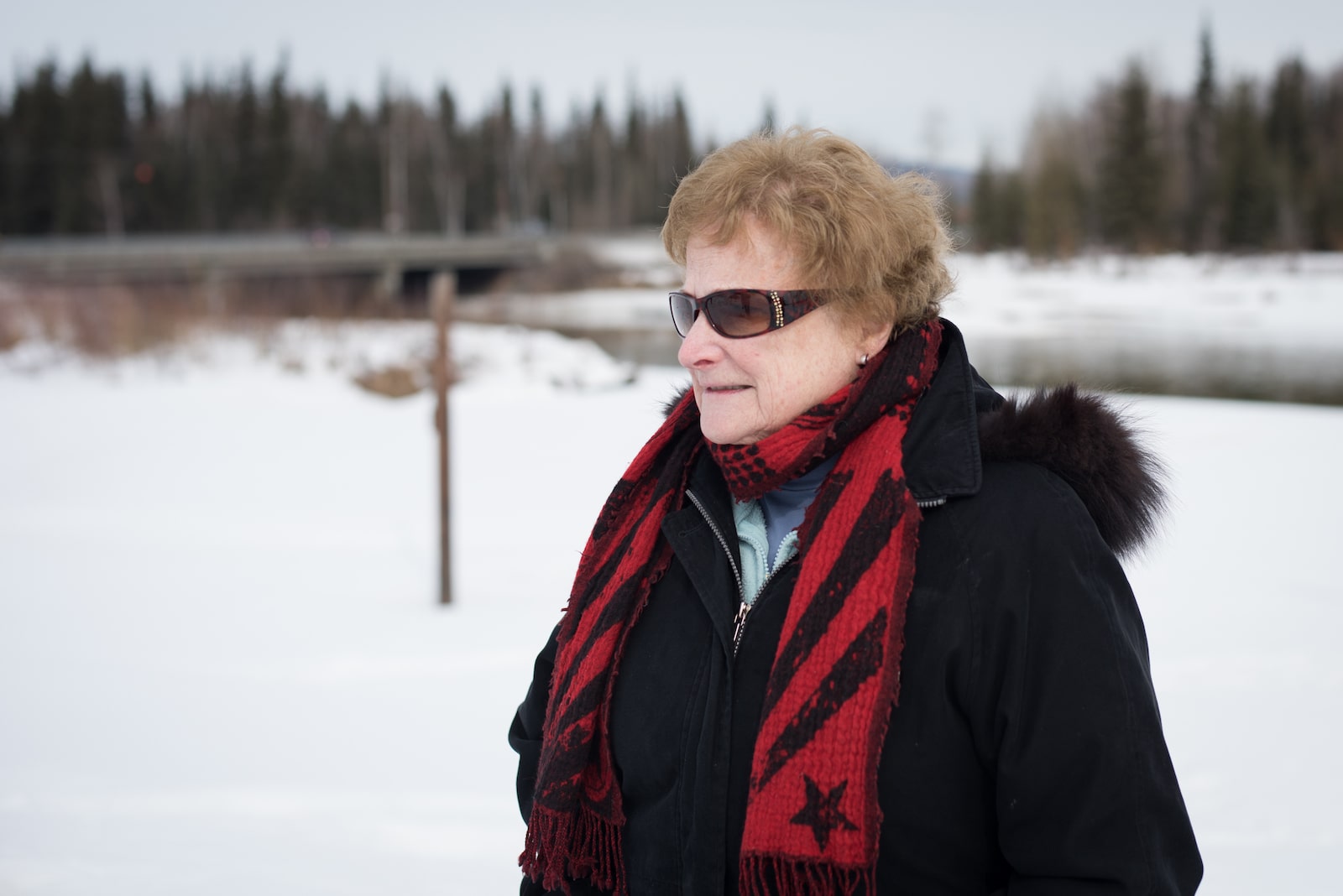
a woman in a red scarf and sunglasses on a snowy day
Barbara Schuhmann stands near the planned haul route for ore mined at Manh Choh. Grist / Sean McDermott

After much pleading from Advocates for Safe Alaska Highways, the DOT hired consulting firm Kinney Engineering to study the potential impacts to roadway infrastructure and safety. The assessment likely won’t be completed before the ore haul begins, but preliminary findings suggest the added traffic will increase crashes. In addition to road conditions, Kinney will also examine factors like the rise in air pollution. Coal-fired power plants, wood-burning stoves, and frequent air inversions have left the Fairbanks North Star Borough with some of the worst air in the country. The Environmental Protection Agency recently warned the borough it may lose $37 million in federal highway funding each year if it doesn’t come into compliance — just as the haul trucks and their emissions hit the road. “At this point, we really do not have the problem defined well enough to come up with solutions,” says Randy Kinney, founder of Kinney Engineering.

These concerns prompted the North Pole City Council and the Fairbanks North Star Borough Assembly  to pass nonbinding resolutions opposing the ore haul last winter, although the borough’s language was softened after a new assembly member received a torrent of angry calls from fellow Republicans. A Kinross representative attended the borough meeting as it was being discussed and reminded everyone that the company is the community’s largest taxpayer. “I asked, ‘Oh, do you think we should treat people differently if they pay more in taxes?’” recalls assemblymember Savannah Fletcher. The opposition was symbolic anyway, she says. “We don’t have the ability to limit who can use these public roadways.” 

three schoolbuses on a snowy road
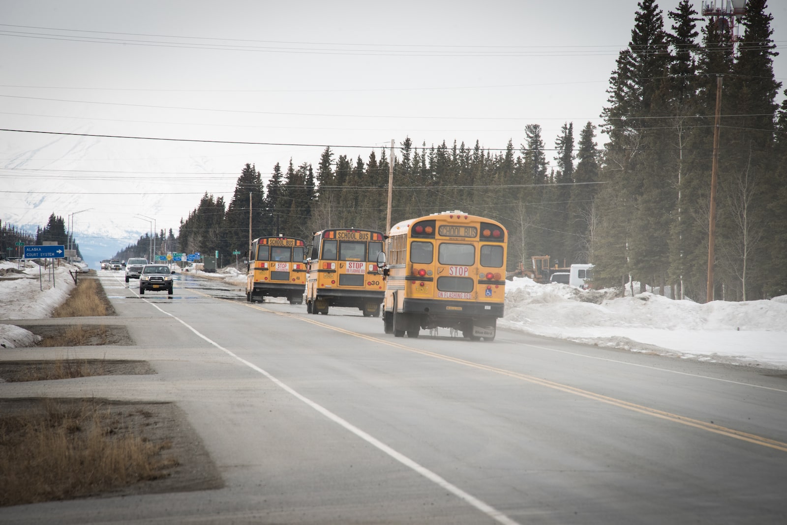
School buses drive the Alaska Highway, the only road from Tok to Fairbanks. The Advocates for Safe Alaska Highways are concerned that mining trucks along the route will be a danger for children at the hundred-plus school bus stops along the ore haul route. Grist / Sean McDermott

Schuhmann argues that the length of the trailers that will haul the ore normally would prohibit Kinross from using the planned route. (The agency claims a clause in state transportation regulations allows long combination vehicles like those Black Gold Transport will deploy to use several primary roads through the heart of Fairbanks. Schuhmann counters that another regulation provides sweeping authority to keep any vehicle off the road in the interest of public safety.) Kinney estimates the ore trucks — passing a dozen traffic signals, over 100 school bus stops, and many driveways through Fairbanks and all along the route — will need at least 365 feet to come to a stop during the winter. Meanwhile, drivers experienced with Arctic roads are already in short supply; the Alaska Trucking Association estimates that the state is currently 500 short of its needs.

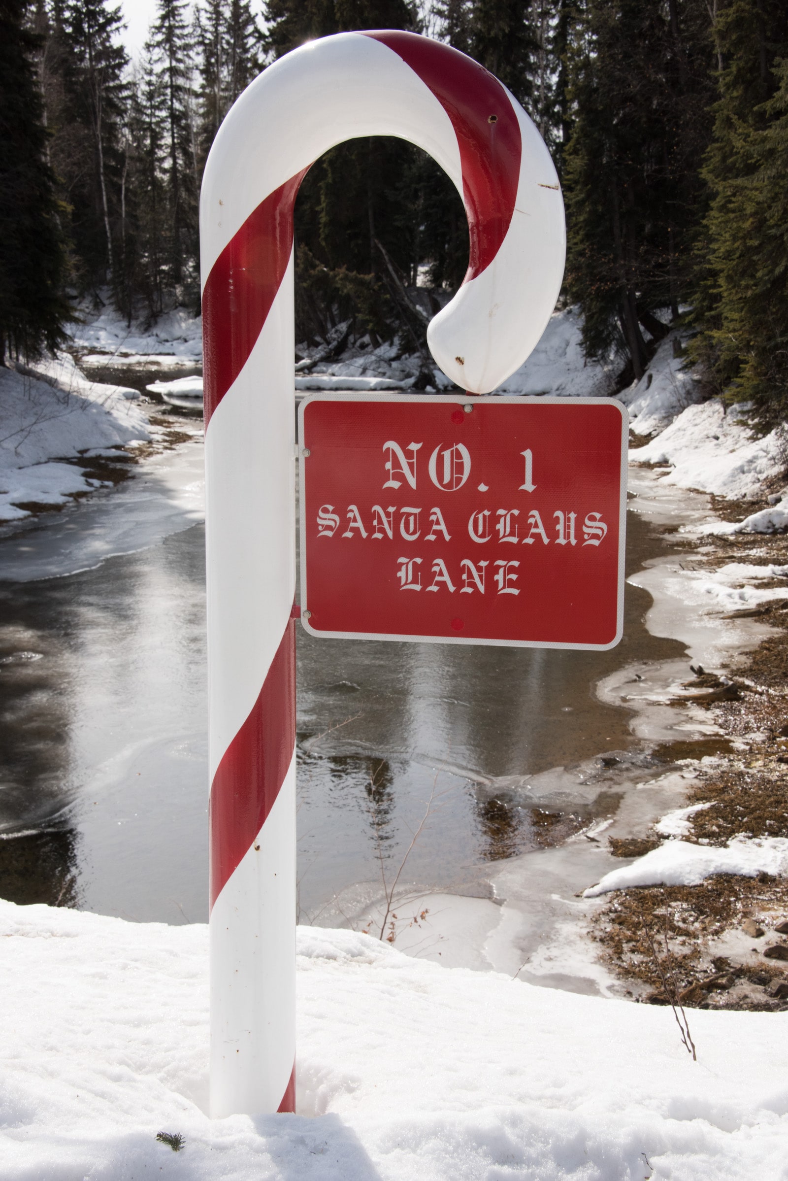
If these trucks have to brake rapidly, they run the risk of jack-knifing, or having the trailer spin forward of the cab. To explain the potential risks, DOT veteran McHattie wrote a tongue-in-cheek poem about Santa’s sleigh running into just such a rig near Dot Lake. “There lies Santa, buried by ore,” he wrote. “Just let the alternative sink into your head. It could have been you and your family instead!” 

a candy cane sign
A candy cane decoration sits outside of North Pole’s city hall. Grist / Sean McDermott

The dark humor helps with his cynicism. “They’re going to kill folks on my highways,” McHattie says. Though he’s a staunch conservative, joining Advocates for Safe Alaska Highways has changed his general outlook, especially “on things that can hurt people.” Later, he pulls out a gold coin. It’s cold and surprisingly heavy. Since Kinross has obtained the necessary permits, he’s fatalistic about the group’s chances of stopping the project. “People have been killing each other for thousands of years over gold,” he says. “This up here is just a much, much watered-down version.”


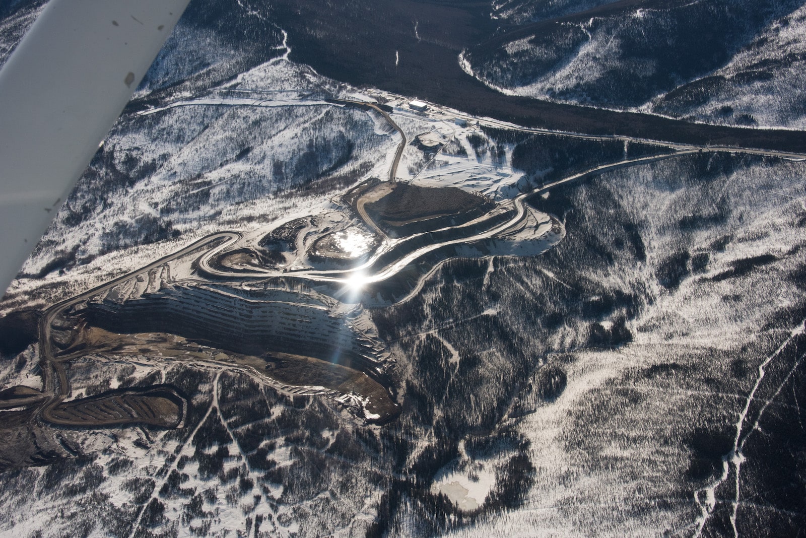
Fort Knox’s pit is so deep it’s difficult to see the bottom, even when flying overhead in a two-seat Cessna. The scars of old placer mines are pockmarked by recent exploration holes, as Kinross expands its footprint. The ore from another new — and also potentially acid-generating — deposit stands out, a darker brown framed by snow.

Alaska’s mines produced $4.5 billion worth of minerals last year. But mining contributes less than 1 percent of state revenue, which in 2021 came to $83 million. The base tax structure for that sector has remained largely unchanged since Alaska became a state in 1959. “There’s probably a lot of merit in revisiting many of the tax structures we have in the state of Alaska,” says state Representative Ashley Carrick, noting that Kinross and its supporters have worked to emphasize mining’s role in the region’s economy. “We have to really think about how we balance the past and current industries with what we want the long-term future to look like,” she adds. She notes, for example, that using highways as haul routes is in direct conflict with the tourism industry. Yet, she says, “Kinross and Contango do not seem moved by the public outcry.”

an airplane view of a brown and white mine
An aerial view of the existing Fort Knox mine, where ore from Manh Choh will be processed. The U.S. Fish and Wildlife Service warns that potentially acid-generating tailings from Manh Choh could harm water quality and fisheries, requiring mitigation in perpetuity. Grist / Sean McDermott

Questions about the role mining will play in Alaska’s economy grow increasingly urgent as companies use the lure of rare earth metals as an excuse to fast-track mine permitting. The U.S. Geological Survey has recently announced a $5.8 million initiative to map the state’s critical minerals, including rare earth deposits like cerium and yttrium as well as minerals important to renewable energy, like cobalt and copper. The governor is currently pushing to take control of wetland permitting from the Army Corps of Engineers, which would allow state agencies to expedite new projects. “It’s going to cost the Alaska taxpayers a fair amount of money,” says Dave Chambers of the Center for Science in Public Participation. He’s concerned that the state lacks both the budget and the technical expertise required. “Unfortunately, there’s no law against being stupid.”

Federal mining law isn’t much better. It was last updated in 1872, prompting U.S. Representative Raúl Grijalva of Arizona to introduce legislation in the spring of 2022 that would modernize a “severely antiquated” statute. The bill would require hard-rock mines to meet similar standards as oil and gas companies on public lands, establish royalties for operations, and conduct meaningful consultation with impacted tribes. (Nearly one-third of the mineral resources needed for the green energy transition are on or near Indigenous land.) 

“If Alaska is transitioning to a mining-based extractive economy, they certainly need to review the percentage of benefits that the public gains,” says Mike Spindler, a former national wildlife refuge manager with decades of experience managing natural resources. “We do need jobs, we do need an economy, we do need critical minerals,” he acknowledges. But he wants it to be done responsibly. Many metals — including gold, which plays little part in the green energy transition — are easily recyclable.  Developing alternative technologies, such as sodium-ion batteries, could also reduce the need for virgin materials. Instead of focusing on new extraction, using materials efficiently and revisiting existing tailings, which often have unutilized minerals, could reduce impacts. 

But rather than modernizing, Manh Choh is setting a return to an era of deregulated mining, says Jeff Benowitz, a Fairbanks-based geologist. Contrary to industry best practices, for example, Kinross has not conducted seismic evaluations at Manh Choh. Earthquakes could have significant impacts on the mine’s hydrology, affecting where acid drainage might migrate. His comments during the public process pointing out these flaws were dismissed by the agencies issuing permits. If Alaska doesn’t do its due diligence, he says, it’s “a problem for the country — the whole United States of America. Because if you can do unregulated mining, why wouldn’t you?”

a man holds a furry white and gray dog
Geologist Jeff Benowitz with his dog, Sonya Creek Volcanic Field, who was named for a geologic formation in Alaska’s Wrangell mountains. Benowitz has raised concerns that the Manh Choh ore haul, and the lack of a comprehensive environmental review, is setting a troubling precedent for mining in Alaska. Grist / Sean McDermott

Mining companies are currently eyeing many other deposits along Alaska’s roads to make it much easier to transport their ore — including the Parks Highway, the state’s primary highway, which runs from Anchorage to Fairbanks. Kinross itself has been open about its intention to use public roads to develop other deposits, telling an industry publication there’s “an economic radius around Fort Knox, given the mill capacity, that makes a good chunk of Alaska attractive.” 

There’s a near future in which many companies are trundling ore alongside tourist RVs and family minivans, compounding the risks. Yet Benowitz has a realistic view about how much outrage Manh Choh’s haul will generate — it’s so far away, most Americans can’t even picture the problems it poses. “I try not to be like, ‘No one cares about the school children, no one cares about air pollution in North Pole or Fairbanks, no one cares about the local fish,’” he says. “But they’re going to care when that’s in their state, and in their county.” 

As a working geologist, Benowitz is concerned about the repercussions questioning the Manh Choh project might have on his career. “But eventually, when you see something that’s really wrong, you have to speak up. The precedent this is setting for the state of Alaska — and for the country — is horrific.” 

Schuhmann also worries about backlash. She’s warned her daughter not to mention the mine in public, and to be cautious when she goes out with friends. Billions of dollars, she knows, are at stake. But she isn’t quitting. Schuhmann sends off another email to the state assistant attorney general about DOT regulations. She gives frustrated scientists matter-of-fact advice on appealing the permitting process. She tries to stay focused on the law that ought to be followed. “I don’t believe in getting angry over cases,” she says. “What’s the impact going to be for Alaskans? Those are the issues, not how I’m feeling.” 

an older woman and a young girl hug
Barbara Schuhmann and her granddaughter hug on an Alaskan spring day. Grist / Sean McDermott

But one overcast spring day, Schuhmann walks along the Chena River with her granddaughter, watching as the season’s first trumpeter swans land in the newly open water. They pause by a bridge that 160,000 pound mining trucks will soon be crossing. “Do these companies ever really reconsider?” she asks, finally showing her exasperation. “I don’t know. It’s hard not to get depressed.” 

We stand there in the snow until our toes get cold, watching as the swans front and bicker like politicians. By then, Schuhmann’s back to business. “We’ll have to just keep our thinking caps on.”

Lois Parshley is an investigative journalist. Read more of her work @loisparshley. This reporting was supported by the Fund for Investigative Journalism. 

This story was originally published by Grist with the headline Alaska is facing a massive mineral boom, but at what cost? on Jul 26, 2023.

Latest Eco-Friendly News